The Baltimore Metropolitan Council (BMC) hosted the Unmanned Aerial Systems (UAS) Information Exchange Forum on Tuesday, December 4, 2018. This event was the culmination of 18 months of planning and generous donations from MSGIC and KCI Technologies.
Date And Time
Tuesday, December 4, 2018
9:30 AM – 4:30 PM EDT
Location
Wilde Lake Interfaith Center
10431 Twin Rivers Rd,
Columbia, MD 21044
Program and Links to Presentations
Introduction and Purpose of Forum
- Eileen Singleton, Principal Transportation Engineer, Baltimore Metropolitan Council
Welcome
- Michael Kelly, Executive Director, Baltimore Metropolitan Council
Getting Started and Regulatory Framework
- Unmanned and Unbound: The Future of Commercial UAS
- Justin Towles, Founding Partner, Ascension Global
- Getting a UAS Pilots License:Why You Need It and What It Takes to Get It
- Professor Scott Jeffrey, Center for Mapping and Analysis Program Director, Community College of Baltimore, Catonsville
- Dr. Doug Williams, Aviation Technology Program Director, Community College of Baltimore, Catonsville
Federal, State, and Local UAS Overview
- Update from Federal Highway Administration
- Connie Yew, Team Leader for Construction Management, Office of Infrastructure, Federal Highway Administration
- Overview of Maryland Association of Counties Activities to Support Local UAS Use (no slides)
- Robin Eilenberg, Research Director, Maryland Association of Counties
- Summary of Maryland Department of Transportation UAS Activities
- Laurie Goudy, IT Director, MDOT State Highway Administration
- Ross Cutts, Engineering Geology Field Manager, MDOT State Highway Administration
Sponsor Lightning Round
Local and State Use Cases of UAS Part 1: Public Sector Perspective
- Queen Anne’s County Drone Program: A Local Government Approach to Drones
- Sam Stanton, GIS Coordinator, Queen Anne’s County GIS
- Tyler Pease, GIS Specialist II, Queen Anne’s County GIS
- Maryland Transportation Authority Crash Response and Reconstruction
- Cpl. Mike Lamont, Commander – Collision Reconstruction, MDTA Police
- Procurement of UAS for Local Use
- Kim Cluney, Program Manager, Anne Arundel County Department of Public Works
- UAS on the Leading Edge of Technology
- Matt Scassero, Director, UAS Test Site
Local and State Use Cases of UAS Part 2: Private Sector Perspective
- Why UAS Will Help Your Organization
- David Headrick, Project Manager, KCI Technologies, Inc.
- Dustin Henry, Assistant Director, KCI Technologies, Inc.
- UAS Photogrammetry: Stormwater Management Existing Conditions Survey
- Eric Cooper, Associate – Chief of Surveys, Wallace Montgomery & Associates
- Pushing Engineering & Construction Boundaries with UAS
- Bryan Haynie, Vice President/Chief of Surveys, Century Engineering, Inc.
Panel Discussion: Key Points from the Day
- Facilitator: Ross Cutts, Engineering Geology Field Manager, MDOT SHA
- Procurement: Andrew Hime, Purchasing Agent, Anne Arundel County
- GIS: Patrick Callahan, GIS Manager, Office of Information Technology, Prince George’s County
- DPW /Transportation: Jeff Hobbs, Chief of Surveys, Howard County Department of Public Works
- Private sector: Al Wainger, Vice President, Michael Baker, Inc.
Closing Remarks
- Mara Kaminowitz, GIS Coordinator, Baltimore Metropolitan Council

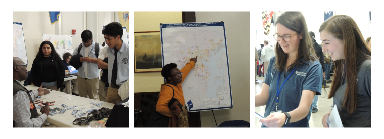
Baltimore City hosted its Annual GIS Day on Friday, November 15th at the War Memorial Building downtown. The event showcased the geospatial and mapping work being done in Baltimore by city agencies and other local organizations.
The gathering included a wide display of data, technology and GIS work open to the public for review and discussion. It also created a platform for exhibitors and attendees to collaborate and share GIS practices with each other.
Exhibitors included many city agencies, MD iMap (MD Department of IT), BMC, Johns Hopkins, and the Baltimore Neighborhood Indicators Alliance. Among the over 300 attendees were city employees from many agencies, members of the community, and students.
The Baltimore Metropolitan Council was excited to be included in the event presenting maps and apps created by our GIS team that illustrate information about the city and its relationship to the broader region. We also spoke about our work in general and how it benefits the city and the region.
At our table, we gave away maps that showed travel patterns to and from the city. This allowed guests to understand where people who work in Baltimore commute from, and where people living in the city go to work.
We also presented our regional bicycle facilities map, which attracted many throughout the day. Attendees were interested in seeing bicycle trails in their neighborhood and comparing facilities across different counties.
Another popular display was our interactive traffic dashboard. I Participants entered their address into the application to look at traffic conditions in their area. This led to conversations about what else BMC was doing to address the issue, including traffic safety and congestion management.
The event welcomed Digital Harbor GIS Track students. The students learned more about professional GIS work. Each student visited the map and data-covered tables, where exhibitors were eager to share their wealth of knowledge and answer questions to encourage their growth and development within the field. While many learned new information about map and data resources from visiting the BMC table, we are proud to note that the students from Digital Harbor plan to use BMC's open data for their school projects.
This is the first year BMC’s GIS team participated in this event. We are fortunate to communicate through our research, data and strategies just how interconnected our region is. We look forward to next year’s event and all that we can learn, give and discuss with next year’s attendees.
 |

