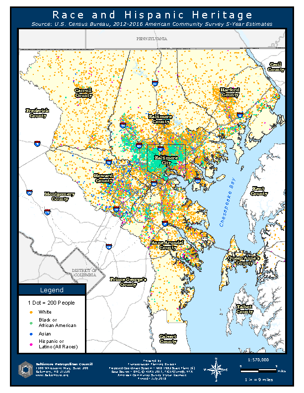
The Baltimore Metropolitan Council uses cartographic products to facilitate coordination between its member jurisdictions as well as help both local government and the public obtain useful information about our region. BMC utilizes the newest technology in support of projects including geoprocessing, modelling, maps, online interactive applications, and dashboards. Topics include demographic trends, examining building permits to understand residential development, and environmental justice. These products illustrate the range of analytic, cartographic, and other technical capabilities of the Baltimore Metropolitan Council staff. Race and Hispanic Heritage This map, made from American Community Survey Data, shows the distribution of different race and ethnic populations in the region.

