BALTIMORE, MD (Monday, April 11, 2022) – Community members from around the Baltimore region are invited to take part in the 25th annual Bike to Work celebration scheduled for Monday, May 16 - Sunday, May 22. Registration is now open by visiting BiketoWorkMD.com.
Participants who register and ride during Bike to Work Week 2022 can pick up a free t-shirt at local bike shops and local Bike to Work celebrations (quantities limited) and have a chance to win prizes including, daily giveaways of gift certificates to local bike shops and a $500 grand prize.
Bike rides to any location are eligible for Bike to Work Week 2022. Consider biking to the store, the playground, around your neighborhood, to work, or school. Explore your community to enjoy the beautiful spring blooms!
Bike to Work Week is supported by donations from generous sponsors: Anne Arundel County Commuter Crew, Baltimore City Department of Transportation (BCDOT), Baltimore and Carroll County Rideshare, Clean Air Partners (CAP), Columbia Association (CA), Downtown Columbia Partnership (DTC), Go Howard, Harford County Public Library (HCPL), Harford Transit LINK, Joe’s Bike Shop, Maryland Department of Transportation (MDOT), Regional Transportation Agency of Central Maryland (RTA), Trek Bicycle Corporation, and media sponsor WBAL-TV.
About Bike to Work Week
The Baltimore Metropolitan Council, and its members, organize the annual Bike to Work celebration in the region. Bike to Work Week is a campaign that celebrates bicycling as a healthy commuting option while promoting public awareness of its safety and environmental benefits. Bike to Work Week helps raise awareness of the rules of the road for drivers, pedestrians, and cyclists, and also highlights the need to improve bicycle facilities to improve safety.
Notice
The Baltimore Regional Transportation Board operates its programs and services without regard to race, color, or national origin in accordance with Title VI of the Civil Rights Act of 1964, and other applicable laws. Appropriate services can be provided to qualified individuals with disabilities or those in need of language assistance who submit a request at least seven days prior to a meeting. Call 410- 732-0500. Dial 7-1-1 or 800-735-2258 to initiate a TTY call through Maryland Relay.
Si se necesita información de Título VI en español, llame al 410-732-0500.
###
The Baltimore Metropolitan Council (BMC) works collaboratively with the chief elected officials in the region to create initiatives to improve our quality of life and economic vitality. BMC, as the Baltimore region’s council of governments, hosts the Baltimore Regional Transportation Board (BRTB), the federal metropolitan planning organization (MPO), and supports local government by coordinating efforts in a range of policy areas including emergency preparedness, housing, cooperative purchasing, environmental planning and workforce development.
BMC’s Board of Directors includes the executives of Anne Arundel, Baltimore, Harford and Howard counties, the mayor of the City of Baltimore, a member of the Carroll County and Queen Anne’s County boards of commissioners, a member of the Maryland State Senate, a member of the Maryland House of Delegates, and a gubernatorial appointee from the private sector.
BALTIMORE, MD (Monday, March 7, 2022) – The Baltimore Regional Transportation Board (BRTB), as the metropolitan planning organization for the Baltimore region, seeks volunteers to serve on a newly formed group, Transportation CORE (Community Outreach and Regional Engagement). Applications are due April 15, 2022.
The BRTB has made an innovative decision to launch Transportation CORE as a new form of public engagement to bring together people from around the region to provide feedback on a range of transportation and planning topics.
Samuel Sneed, Chair of the BRTB says “Public engagement is vital to the regional planning process and the BRTB’s Transportation CORE offers the public an exciting new way of connecting with the transportation planning process. Through regular online engagement, your voice can help improve the quality of life in the Baltimore region.”
Interested in joining? More details about the Transportation CORE and how to apply are below.
About the Transportation CORE
Core goals of the Transportation CORE are:
- To provide opportunities for various interested parties to have input on how BRTB approaches project planning, prioritization of projects and initiatives, and public involvement.
- To expand our reach beyond BRTB committees and long-time partners to make sure that rural, suburban and urban communities and business interests from across the Baltimore region are represented.
- To bring new and emerging concerns and issues to BRTB/BMC’s attention by members who will also serve as local “eyes and ears” about transportation throughout the region.
Membership
We are seeking up to 50 participants to form the initial Transportation CORE, including neighborhood residents and business owners, equity, and transportation advocates, non-profit leaders, and representatives of the various interested parties and key stakeholders that are essential to include in the planning process.
Participants should:
- Be age 18+
- Live or work in the region
- Have an interest in helping to inform the region’s transportation planning process;
- Be willing and able to participate in eight (8) to 10 interactive online activities throughout the year such as brief surveys, preference polls, or review of draft materials
- Be willing to participate in two (2) to three (3) virtual public meetings per year
- Be open to participate in an annual summit meeting or workshop (in-person or virtually)
Transportation CORE Activities - The Transportation CORE will be engaged throughout the year primarily via “asynchronous” online activities that members complete at their convenience. The kinds of activities could include surveys, reviewing draft materials, threaded chats, and virtual meetings to get project updates from planning staff.
Apply Today at bit.ly/3g2LDZn.
Applications are due April 15, 2022. Applications received after this time will be considered on a rolling basis. Transportation CORE participants will be chosen by a panel of representatives from the BRTB members and BMC staff.
For more information:
Monica B. Haines Benkhedda at transportationCORE@PublicInput.com or 410-732-0500 x1047.
Notice
The Baltimore Regional Transportation Board operates its programs and services without regard to race, color, or national origin in accordance with Title VI of the Civil Rights Act of 1964, and other applicable laws. Appropriate services can be provided to qualified individuals with disabilities or those in need of language assistance who submit a request at least seven days prior to a meeting. Call 410- 732-0500. Dial 7-1-1 or 800-735-2258 to initiate a TTY call through Maryland Relay.
Si se necesita información de Título VI en español, llame al 410-732-0500.
###
The Baltimore Metropolitan Council (BMC) works collaboratively with the chief elected officials in the region to create initiatives to improve our quality of life and economic vitality. BMC, as the Baltimore region’s council of governments, hosts the Baltimore Regional Transportation Board (BRTB), the federal metropolitan planning organization (MPO), and supports local government by coordinating efforts in a range of policy areas including emergency preparedness, housing, cooperative purchasing, environmental planning and workforce development.
BMC’s Board of Directors includes the executives of Anne Arundel, Baltimore, Harford and Howard counties, the mayor of the City of Baltimore, a member of the Carroll County and Queen Anne’s County boards of commissioners, a member of the Maryland State Senate, a member of the Maryland House of Delegates, and a gubernatorial appointee from the private sector.

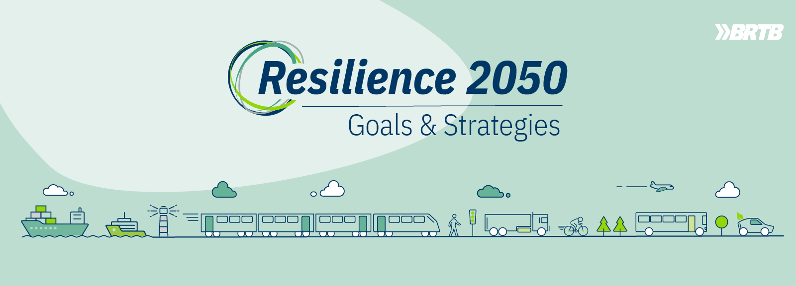
BRTB Launches Resilience 2050 White Papers to Inform the Public on the LRTP currently in Development.
The Baltimore Regional Transportation Board (BRTB) has launched a series of white papers to engage the public throughout the planning process for Resilience 2050: Adapting to the Challenges of Tomorrow, the next long-range transportation plan (LRTP) for the Baltimore region.
These targeted white papers will engage the public earlier and more effectively by providing information about the planning process and concisely explaining some of the complex information presented in the LRTP.
The white papers are an exciting tool that aim to improve the review process as they introduce and update the public on the LRTP over time and by topic, providing exposure prior to release of the draft of Resilience 2050 in spring 2023. It also encourages the public to provide feedback earlier in the process. This allows the BRTB to hear thoughts and ideas about Resilience 2050 while it is still in development, which is a more impactful time for consideration and inclusion of relevant feedback.
White papers will be released monthly over the course of the next year in preparation for the full draft plan, slated for completion in the spring of 2023.
The first white paper, Project Scoring, is now available, detailing the methodology for scoring candidate projects for Resilience 2050.
Readers can anticipate more Resilience 2050 white papers on topics such as:
- Traffic safety issues in the Baltimore region;
- The regional freight network;
- Transit;
- Air quality and the Conformity Analysis;
- Active transportation
- Forecasting population, households, and employment for Resilience 2050
- Emerging technologies
To read and provide input on the project scoring white paper and any future Resilience 2050 white papers, visit https://publicinput.com/resilience2050whitepapers
To learn more about the long-range transportation plan, visit resilience2050.com.
The Baltimore Regional Transportation Board (BRTB) welcomes comments on its draft updated work plan and budget through Thursday, March 10, 2022.
The BRTB is scheduled to vote on the updated budget for FY 2023 on Tuesday, April 26, 2022.
What is the UPWP?
The BRTB’s Budget & Work Program is known as the Unified Planning Work Program (UPWP) for Transportation Planning. It is a federal requirement that details projects, studies and other activities to be completed by BRTB members and staff of the Baltimore Metropolitan Council (BMC).
The BRTB develops this list of regional transportation planning activities every two fiscal years. This UPWP includes an updated budget for FY 2023 of $7,370,000. UPWP funds support staff for regional planning activities with some consultant assistance.
Several of the new proposed projects for FY 2023 include:
- Safe System Approach: Support a safety culture that places safety first and foremost in road system investment decisions. To achieve a zero deaths vision, everyone must accept that fatalities and serious injuries are unacceptable and preventable.
- Thirty Percent Design for Bicycle Trails: Advance planning for a segment of the Patapsco Regional Greenway to include all steps necessary to complete what is known as thirty percent design.
- RTP LOTS Skills and Technology Support: Support the improvement and expansion of skills and access to technology for the Locally Operated Transit Systems (LOTS) in the Baltimore region.
- Expanding Coverage for Electric Vehicle Charging Stations: To support regional and equitable expansion of public light duty electric vehicle (EV) charging station infrastructure in the region.
- Considerations and Preparations for Connected and Automated Vehicles: Develop customized recommendations for the region to prepare for connected and automated vehicles.
View the FY 2023 UPWP | Read a list of Frequently Asked Questions | Watch a recorded overview
Share Your Thoughts
Public input is essential to the development of the UPWP and we encourage people to view the draft document and tell us what you think.
The public is invited to provide feedback on the updated FY 2023 budget and proposed regional transportation planning activities from Tuesday, February 8 through Thursday, March 10, 2022.
View Comments and BRTB Response
Please send all comments using one of the following options:
|
Online: |
|
|
Text: |
Text the phrase ‘2023upwp’ to the number 73224 |
|
Voicemail: |
Call toll free 855-925-2801 x 4231 and leave us a voicemail |
|
Email: |
|
|
Twitter: |
Direct Message @BaltoMetroCo or @BmoreInvolved or use the hashtag #BRTBlistens |
|
Mail: |
The Baltimore Regional Transportation Board |
To learn more about the UPWP and the proposed updated budget and projects, please view a recorded presentation.
The public may also provide feedback during the Public Comment Opportunity at the BRTB monthly meetings on February 22 or March 22 or when the BRTB votes on April 26, 2022. Due to the public health concerns presented by the Coronavirus (COVID-19), all scheduled meetings will take place virtually. Please check the calendar for an updated schedule and links to attend the virtual meetings.
The BRTB is the federally recognized metropolitan planning organization (MPO) for transportation in the region. BMC provides the BRTB with staff support.
The Baltimore Regional Transportation Board operates its programs and services without regard to race, color, or national origin in accordance with Title VI of the Civil Rights Act of 1964, and other applicable laws. Appropriate services can be provided to qualified individuals with disabilities or those in need of language assistance who submit a request at least seven days prior to a meeting. Call 410- 732-0500. Dial 7-1-1 or 800-735-2258 to initiate a TTY call through Maryland Relay. Si se necesita información de Título VI en español, llame al 410-732-0500.
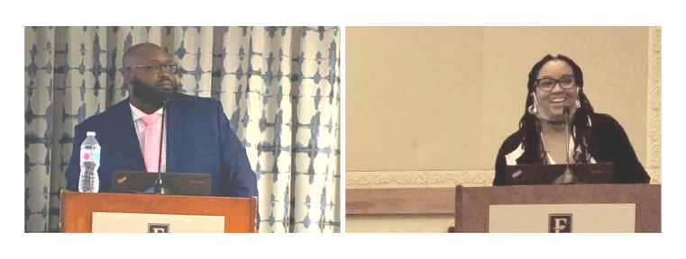
The Baltimore Regional Transportation Board (BRTB) along with the Intelligent Transportation Society of Maryland (ITSMD) held its joint Annual Meeting and BRTB Traffic Signal Forum on Thursday, November 4. Due to the ongoing pandemic, the event was held virtually this year.
The event brings together traffic and transportation professionals from the public and private sectors from across the state and region. The morning keynote address was delivered by Dr. Tim Kerns, Director, Maryland Department of Transportation (MDOT) Highway Safety Office, to focus attention on the troubling trend of increasing highway crashes, fatalities and serious injuries and challenged the attendees to work with state and local partners to help reverse the trend. Mr. Todd Lang, Director, Transportation Planning, Baltimore Metropolitan Council (BMC) delivered the closing keynote, on topics ranging from safety and signal operations to long range planning and the infrastructure bill being debated in congress.
Breakout sessions focused on signal operations and safety, connected and autonomous vehicles, and Transportation Systems Management & Operations (TSMO). A panel discussion on what a post-COVID transportation landscape might look like featured experts from freight, law enforcement, traffic data analysis, and private industry.
The virtual forum had 220 registered attendees. Guests included staff from local and state departments of transportation and public works, traffic engineers, signal engineers, planners, transportation system operators; private sector companies involved in consulting, providing/installing/maintaining/designing traffic signal equipment and ITS equipment, Metropolitan Planning Organizations (MPOs), Federal Highway Administration (FHWA) and academia. The event also included several exhibitors from public and private sectors.
For more information and to see the program, presenter bios, list of attendees, sponsors and exhibitors, please visit https://itsmd21.kujenga.tech/.
The Association of Metropolitan Planning Organizations (AMPO) held their annual conference from Tuesday, October 5th through Friday, October 8th, 2021. The conference attracted over 300 attendees from 80 metropolitan areas.
The BRTB participated in many ways throughout the conference. BRTB Chair, Ramond Robinson, moderated a session on Transit Planning and Travel Behavior, where presenters discussed the Regional Transportation Commission’s (Southern Nevada) On-Board Mobility Plan process and Metropolitan Washington Council of Government’s (MWCOG) strategies on how to encourage commuters to reconsider transportation options and habits.
BRTB Vice Chair, D’Andrea Walker, moderated a session on Transit, where presenters discussed the Fredericksburg Area MPO’s attempt to understand mode choice and MWCOG shared how they are advancing aspirational transit projects.
BMC Transportation Director, Todd Lang, moderated a panel on Activity Based Modeling, exploring AMPO’s ActivitySim consortium model and project progress to date, and more.
BMC Assistant Transportation Director, Regina Aris, moderated sessions on Partnerships and Core Products featuring Memphis Area MPO and the Denver Regional Council of Governments. Presenters shared best practices for Transportation Improvement Program (TIP) planning, programming, project tracking, coordination and using scenario planning for their long-range transportation plan update.
BMC’s Bala Akundi presented on implementing a Safe Systems Approach. This panel discussion explored opportunities for MPO’s to integrate a new FHWA framework, the Safe System Approach.
The BRTB was largely engaged in sessions, participating in many panel discussions while sharing strategies, experiences, learnings and challenges. Our staff and board took advantage of the opportunity to, yet again, be in a space where we could learn from peer MPOs and provide guidance on our unique methodologies that have brought us success over the last year.
Mr. Lang is in the final year of his elected position on the AMPO Board of Directors and with the American Public Transportation Association (APTA) Metropolitan Planning Subcommittee.
The AMPO is a resource for MPOs throughout the country, providing a platform for training, education, case studies, networking, peer-exchange and more.
 |
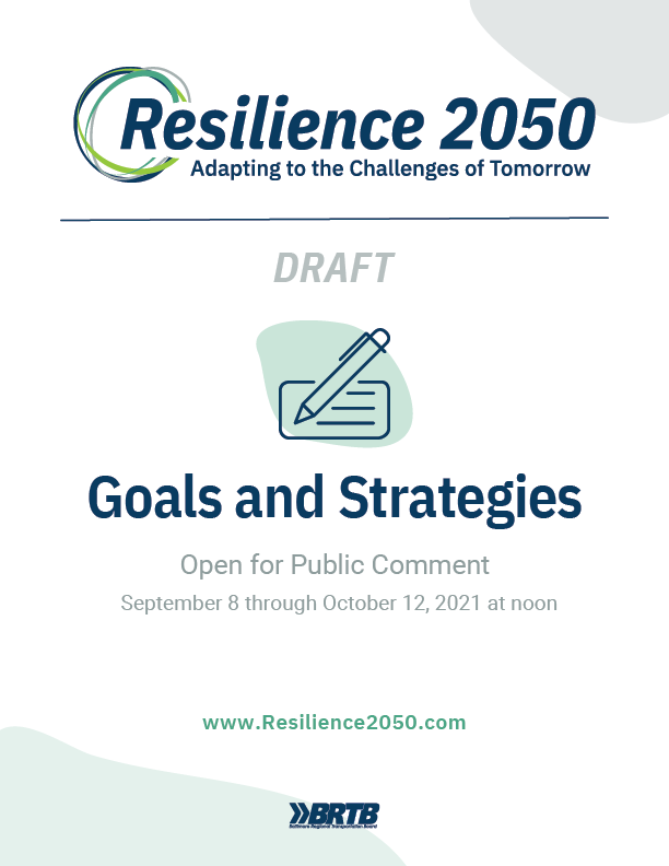
The Baltimore Regional Transportation Board (BRTB), as the metropolitan planning organization (MPO) for the Baltimore region, seeks public comments through Tuesday, October 12 on the draft goals and strategies for Resilience 2050: Adapting to the Challenges of Tomorrow.
Details about the draft goals and strategies for Resilience 2050, and how to provide comments, are available below.
About the Resilience 2050 Goals and Strategies
As part of the development of the next long-range transportation plan, Resilience 2050, to be adopted in 2023, the BRTB is considering a revised set of regional goals and strategies.
The proposed goals represent broad aspirations for the regional transportation system, including:
| Goals that address the basic functions of transportation | Goals that address the conditions or effects of transportation | Goals that address the transportation decision-making process |
|---|---|---|
|
|
|
The BRTB is also considering multiple strategies for each goal. Strategies are approaches or policies to help the region to implement a goal. For example, “eliminate hazardous or substandard conditions in high-crash locations and corridors” is a specific strategy that can help the region to “improve system safety,” the regional goal.
View the draft goals and strategies | Watch an overview of the Goals and Strategies
Share Your Thoughts
Public comments are welcome from Wednesday, September 8 through Tuesday, October 12, 2021 at noon. The BRTB will vote on the Resilience 2050 goals and strategies on Tuesday, November 30, 2021.
To share your thoughts and ideas, send all comments in writing to:
| SURVEY | TEXT | VOICEMAIL | FAX | ||
| publicinput.com/resilience2050goals | Text “resilience2050goals” to 855-925-2801 to take our survey |
855-925-2801 x 8248 | resilience2050goals@PublicInput.com |
Use: |
410-732-8248 |
Comments are also welcome during the public comment opportunity at the BRTB meetings at 9 a.m. on Tuesday, September 28 or Tuesday, November 30 (scheduled vote).
View
Comments Received | BRTB Response to Comments
For more information:
Zach Kaufman, zkaufman@baltometro.org
Notice
The Baltimore Regional Transportation Board operates its programs and services without regard to race, color, or national origin in accordance with Title VI of the Civil Rights Act of 1964, and other applicable laws. Appropriate services can be provided to qualified individuals with disabilities or those in need of language assistance who submit a request at least seven days prior to a meeting. Call 410-732-0500.
The Baltimore Regional Transportation Board (BRTB), as the metropolitan planning organization for the Baltimore region, seeks public comments from Thursday, September 30, 2021 through Friday, October 29 on the preferred alternatives for a new section of the Patapsco Regional Greenway in Carroll County. The BRTB invites the public to learn more about these proposed alignments at a public meeting on Thursday, September 30 at 6:00 p.m.
In 2017, the BRTB approved a concept plan for the Patapsco Regional Greenway, which will be used by bicyclists, hikers, runners, walkers, and in some locations, equestrians. To date, over 12 miles of the greenway have been completed. Now, the BRTB seeks your input on the preferred alignments for the Sykesville to McKeldin Segment, which will add another 8.5 miles to the greenway.
Details about the comment period and how to provide comments are available below.
About the Patapsco Regional Greenway
The Patapsco Regional Greenway maps the main alignment of a 40-mile, shared-use trail traveling through the Patapsco Valley from Sykesville in Carroll County to Baltimore’s Inner Harbor. The trail, when completed, would pass through or near the communities of Sykesville, Marriottsville, Woodstock, Daniels, Oella, Ellicott City, Catonsville, Elkridge, Halethorpe, Baltimore Highlands, and Cherry Hill. The Patapsco Regional Greenway will serve as a region-wide asset and provide nearby communities with a sustainable transportation route and miles of recreational trails.
About the Sykesville to McKeldin Area Project
The Sykesville to McKeldin Segment of the Patapsco Regional Greenway consists of two sections - 1) the western portion near downtown Sykesville and 2) the eastern portion near the McKeldin area of the Patapsco Valley State Park.
In Spring 2021, a comment period was held to gather feedback on the alignment of each of these trail segments. After reviewing comments, a route for each section was selected. Details are below.
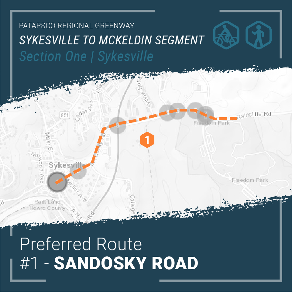
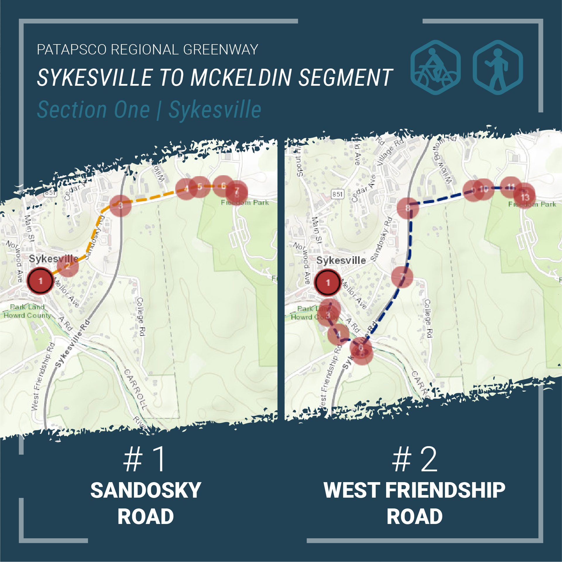
Section 1 - Western Portion: Main Street Sykesville to Freedom Park
The western portion will connect downtown Sykesville shops, dining, and residences along Main Street to active and passive recreation opportunities in Freedom Park. This section of the trail is intended for low impact trail users such as walkers and cyclists and will consist primarily of paved shared use paths, on-road facilities, and a boardwalk structure along Sandosky Road.
Two alignment alternatives for Section 1 were considered during the public input period this Spring. The design team considered public comments, steering committee comments, local advisory committee comments, and general design principles in identifying the Sandosky Road alignment as the preferred alignment.
The Sandosky Road alignment is a paved shared use path that travels from Main Street in downtown Sykesville, north along Sandosky Road, crossing MD 32 to Raincliffe Road and finally into Freedom Park via the Buttercup Road intersection.
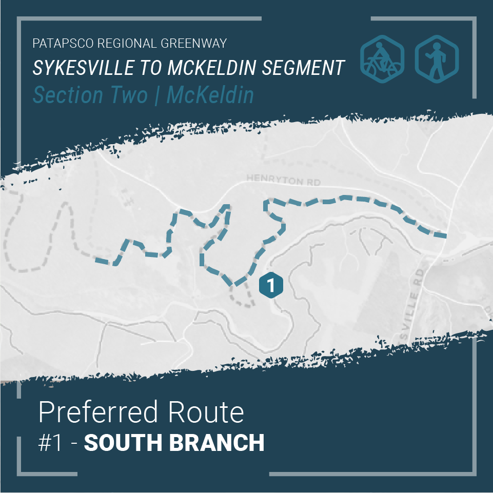
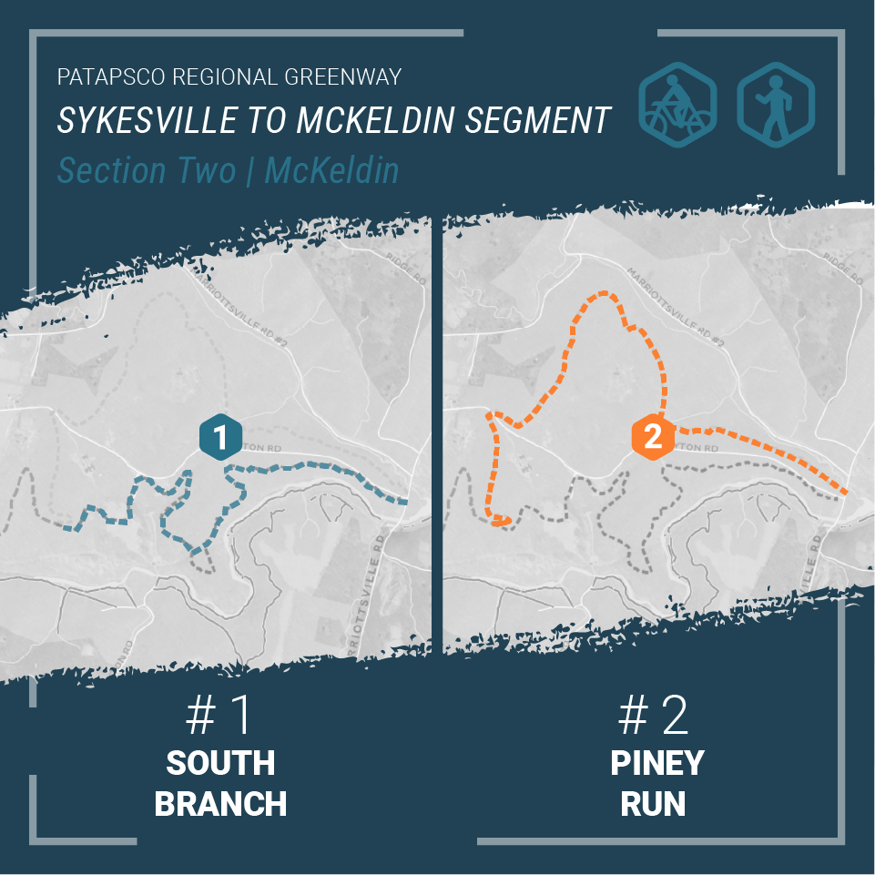
Section 2 - Eastern Portion: Freedom Park to the McKeldin Area in Patapsco Valley State Park
Users of this section of the trail will encounter dense forest, scenic views, ruins of abandoned structures, stream crossings, and many other points of interest. The design will highlight the natural and cultural wonders of the park integrating high overlooks, rock formations, and archaeological treasures. The natural surface trail will serve hikers, mountain bikers, and equestrian riders with a sustainably constructed unpaved trail.
Similar to the western portion, the eastern portion considered two alignment alternatives through the Patapsco Valley State Park. The eastern portion of the multi-use trail will connect Freedom Park with the McKeldin Area of the Patapsco Valley State Park. Utilizing public comments, steering committee comments, advisory committee comments, and sound engineering judgement, the South Branch alignment was selected as the preferred alignment.
The South Branch alignment begins in Freedom Park and meanders through Patapsco Valley State Park towards the Heart of Maryland Bowhunters Club property. From there, the multi-use trail veers south towards the South Branch of the Patapsco River crossing over the historic Henryton rail tunnel, through the historic Henryton Sanitorium, paralleling Henryton Road and finally crossing Marriottsville Road before ending in the McKeldin area of the Patapsco Valley State Park.
Share Your Thoughts
The public is invited to share their feedback on the preferred alternatives for the Patapsco Regional Greenway: Sykesville to McKeldin Segment from Thursday, September 30, 2021 through Friday, October 29, 2021.
A virtual public meeting was held on September 30, 2021 to share information about this project and the preferred alternatives.
View the Recorded Presentation
There are also several ways you can provide comments in writing:
- Add your comments to our project page at https://publicinput.com/prgsykesville
- Email your thoughts to prgsykesville@PublicInput.com
- Text prgsykesville to 855-925-2801 to share your comments
- Call us at 855-925-2801 x 3163 and leave a voicemail with your feedback
- @BaltoMetroCo @BmoreInvolved | Use #BRTBlistens
For more information:
Contact Keith Kucharek, Transportation Planner, by email at kkucharek@baltometro.org, or by phone at 410-732-0500 x1052.
Notice
The Baltimore Regional Transportation Board operates its programs and services without regard to race, color, or national origin in accordance with Title VI of the Civil Rights Act of 1964, and other applicable laws. Appropriate services can be provided to qualified individuals with disabilities or those in need of language assistance who submit a request at least seven days prior to a meeting. Call 410- 732-0500. Dial 7-1-1 or 800-735-2258 to initiate a TTY call through Maryland Relay. Si se necesita información de Título VI en español, llame al 410-732-0500.
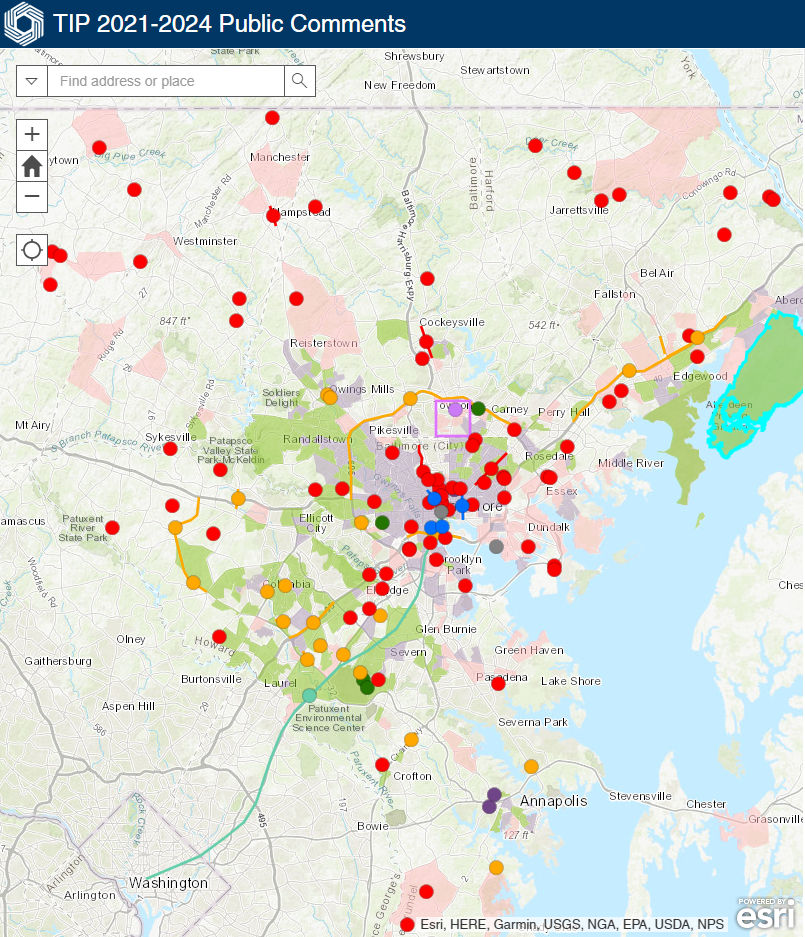
The Baltimore Regional Transportation Board (BRTB), as the metropolitan planning organization (MPO) for the Baltimore region, seeks public comments through Friday, July 9 on two transportation-related documents – the draft 2022-2025 Transportation Improvement Program (TIP) and the associated Air Quality Conformity Determination.
Returning this year is an interactive project map, in which the public can view projects and offer comments. Staff have also created an interactive story map to offer the public an easy way to learn more about these plans. Details about the TIP and Conformity Determination, and how to provide comments, are available below.
Draft 2022-2025 TIP | Draft Air Quality Conformity Determination | How to Comment
Draft 2022 – 2025 Transportation Improvement Program (TIP)
The draft 2022-2025 TIP is the list of regional transportation projects requesting federal funding in the near term. It includes $4.04 billion in proposed funding (federal, state, local, toll revenue) for highway, transit, bicycle and pedestrian projects during the next four years. The funding goes toward maintaining, operating and expanding the transportation system. These projects support regional goals such as accessibility, safety, and prosperity. Funding identified in the TIP is based on funding reasonably expected to be available from all sources.
The draft 2022-2025 TIP includes 129 projects, 6 of which are new. Highlights include:
- Anne Arundel County is dedicating $14 million in funding for a multi-modal transportation center in Parole at the Westfield Annapolis Mall to serve existing local and regional bus service, with possible future connectivity to modes such as bikeshare, carshare, and ride hailing services;
- Baltimore City, in partnership with the state of Maryland, is investing $12.6 million in an East-West Priority Bus Corridor, which will provide a comprehensive suite of investments facilitating more efficient transit trips, improving multimodal connections, and addressing existing safety issues.
- Baltimore City is also moving forward on vital roadway rehabilitation investments, including bicycle and pedestrian improvements, on portions of Belair Road, 25th Street, Fremont Avenue, Madison Street, Park Heights Avenue, Patapsco Avenue, and Pennington Avenue.
- Carroll and Harford Counties are dedicating federal and local funding for 20 essential bridge improvement projects.
- Howard County continues progress on a $27 million project at the US 29 and Broken Land Parkway Interchange which will provide new direct connections from the westbound US 29/Broken Land Parkway interchange ramp to a new road (Merriweather Drive) and to Little Patuxent Parkway. The project will also provide a direct connection from Merriweather Drive to Broken Land Parkway.
- MDOT SHA is dedicating $281 million in the draft 2022-2025 TIP on expanding the Baltimore Beltway (I-695) from I-70 to MD 43 by converting the inside shoulder into a new travel lane from I-70 to MD 43 and on reconstructing the interchange of I-695 and I-70.
- The Maryland Port Administration is partnering with CSX to leverage federal grant funding to reconstruct the 125-year-old Howard Street Tunnel in order to create double-stack rail access to and from the Port of Baltimore.
- The Maryland Transportation Authority (MDTA) is investing $102 million in toll revenues through 2027 on a project at the I-895/Baltimore Harbor Tunnel Toll Plaza replacing the existing toll booths with an overhead gantry which will eliminate traffic queues, improve vehicular and employee safety, and reduce vehicle emissions and fuel consumption.
- MDTA also continues engineering and construction on a $1.1 billion project in Baltimore and Harford Counties adding two additional Express Toll Lanes on I-95 from north of MD 43 to north of MD 24. This project is funded with toll revenues.
Please view the draft 2022-2025 TIP through the BRTB’s interactive project map or learn more in our story map. The draft 2022-2025 TIP is also available in PDF format for download:
Draft 2022-2025 TIP
Introduction and Background | Financial Plan
Projects by jurisdiction: Low-income and Minority Concentration | Appendices
Projects in the draft TIP are also available to review in pdf format by project sponsor, either a local jurisdiction or state agency:
Anne Arundel County | Baltimore City | Baltimore County
Carroll County | Harford County | Howard County
Maryland Port Administration | Maryland Transportation Authority
MDOT MTA | MDOT SHA and the Office of the Secretary
Analysis of Air Quality Conformity
The Baltimore region does not meet the National Ambient Air Quality Standards and so must review its current transportation plans and programs to ensure conformity with the State Air Quality Implementation Plan (SIP).
The Air Quality Conformity Determination report details a comprehensive analysis of Baltimore region mobile source emissions as a result of implementing the draft 2022-2025 TIP. Highlights of the report include:
- Staff from BMC and the Maryland Department of the Environment (MDE) used the Motor Vehicle Emission Simulator (MOVES) 2014a model, developed by the U.S. Environmental Protection Agency (EPA) to analyze the amount of mobile source emissions generated from vehicle travel associated with the implementation of the projects in the draft TIP.
- The report addresses mobile source emissions of VOC and NOx, which are precursors of ground-level ozone emissions.
- Adopted forecasts for population, housing, and employment in the Baltimore region were used for this conformity analysis.
- Current data about the types and purpose of vehicles, fuel data, and meteorological data were used as input into the analysis.
- This Conformity Determination shows that transit ridership is projected to increase from 2022 to 2045.
- Projected mobile source emissions for draft 2022-2025 TIP are well below the motor vehicle emission budgets set in the state implementation plan, or SIP.
- Implementation of the projects proposed in the draft 2022-2025 TIP will not worsen the region’s air quality or delay the timely attainment of national air quality standards.
The conformity determination is available in PDF format for download. Download the Draft Conformity Determination of the draft 2022-2025 TIP:
Conformity Determination | Appendices
Share Your Thoughts
Public comments are welcome from Tuesday, June 8 through Friday, July 9, 2021. The BRTB will vote on these documents on Tuesday, July 27, 2021.
Public Comments Received | BRTB Response to Comments
Join Us for a Virtual Public Meeting
Those interested in learning more about the draft 2022-2025 TIP and Air Quality Conformity may do so during a virtual public meeting on:
To share your thoughts and ideas, send all comments in writing to:
| ONLINE | VOICEMAIL | FAX | ||
| https://publicinput.com/H2050 | H2050@PublicInput.com | @BaltoMetroCo @BmoreInvolved #BRTBlistens |
855-925-2801 x 8248 | 410-732-8248 |
Comments are also welcome during the public comment opportunity at the BRTB meetings at 9 a.m. on Tuesday, June 22, or Tuesday, July 27 (scheduled vote).
Note: MDOT MTA, in lieu of a separate mandated public comment period, has exercised its option to use the procedures of the BRTB’s public involvement process for the 2022-2025 TIP. The public participation process for the TIP meets the Federal Transit Administration (FTA) public participation requirements for MDOT MTA’s Program of Projects (POP).
For more information:
Contact Regina Aris, assistant transportation director, by email at raris@baltometro.org, or by phone at 410-732-9572.
Notice
The Baltimore Regional Transportation Board operates its programs and services without regard to race, color, or national origin in accordance with Title VI of the Civil Rights Act of 1964, and other applicable laws. Appropriate services can be provided to qualified individuals with disabilities or those in need of language assistance who submit a request at least seven days prior to a meeting. Call 410-732-0500.
The Baltimore Regional Transportation Board (BRTB), as the metropolitan planning organization for the Baltimore region, seeks public comments through Friday, June 11 on a new section of the Patapsco Regional Greenway in Carroll County and Howard County.
In 2017, the BRTB approved a concept plan for the Patapsco Regional Greenway, which will be used by bicyclists, hikers, runners, walkers, and in some locations, equestrians. To date, over 12 miles of the greenway have been completed. Now, the BRTB seeks your input on the Sykesville to McKeldin Segment, which will add another 8.5 miles to the greenway.
Details about the comment period and how to provide comments are available below.
About the Patapsco Regional Greenway
The Patapsco Regional Greenway maps the main alignment of a 40-mile, shared-use trail traveling through the Patapsco Valley from Sykesville in Carroll County to Baltimore’s Inner Harbor. The trail, when completed, would pass through or near the communities of Sykesville, Marriottsville, Woodstock, Daniels, Oella, Ellicott City, Catonsville, Elkridge, Halethorpe, Baltimore Highlands, and Cherry Hill. The Patapsco Regional Greenway will serve as a region-wide asset and provide nearby communities with a sustainable transportation route and miles of recreational trails.
About the Sykesville to McKeldin Area Project
The Sykesville to McKeldin Segment of the Patapsco Regional Greenway consists of two sections - 1) the western portion near downtown Sykesville and 2) the eastern portion near the McKeldin area of the Patapsco Valley State Park.
Section 1 - Western Portion: Main Street Sykesville to Freedom Park
The western portion will connect downtown Sykesville shops, dining, and residences along Main Street to active and passive recreation opportunities in Freedom Park. There are two alignment alternatives for Section 1 - Western Portion: Main Street to Freedom Park.
- Alignment 1: Sandosky Road
A shared-use trail travels from Main Street in downtown Sykesville, then north along Sandosky Road to Raincliffe/Buttercup Road intersection, and finally into Freedom Park. - Alignment 2: MD 32
Begins on Main Street in downtown Sykesville and travels south. The shared-use trail crosses the Patapsco River and turns onto West Friendship Road. The trail then turns onto River Road and travels south. The trail re-crosses the Patapsco River along an abandoned vehicular overpass and continues north along MD 32 to rejoin the sidewalk on Raincliffe Road. And finally the trail travels briefly south from the Raincliffe/Buttercup Road intersection into Freedom Park.
Both options will explore sidewalks and paved pathways to accommodate safe and comfortable use by pedestrians and bicyclists.
Section 2 - Eastern Portion: Freedom Park to the McKeldin Area in Patapsco Valley State Park
The eastern portion of the shared-use trail will connect Freedom Park with the McKeldin Area of the Patapsco Valley State Park. There are two alignment alternatives for Section 2 - Eastern Portion: Freedom Park to McKeldin Area.
- Alignment 1: South Branch
Meanders through Patapsco Valley State Park towards the Heart of Maryland Bowhunters Club property. From there, the shared-use trail veers south towards the South Branch of the Patapsco River. The trail then follows the South Branch to Marriottsville Road and crosses Marriottsville Road before ending in the McKeldin area of the Patapsco Valley State Park. - Alignment 2: Piney Run
Follows the same path as Alignment 1: South Branch until the shared-use trail passes beyond the Heart of Maryland Bowhunters Club property. The trail then travels north up and around the League of Maryland Horsemen property towards Piney Run. The trail veers south and parallels Piney Run until the trail reaches Marriottsville Road. After crossing Marriottsville Road, the trail follows the Alignment 1: South Branch before ending in the McKeldin Area of the Patapsco Valley State Park.
Both options will follow a similar path through the Patapsco Valley State Park encountering dense forest, scenic views, ruins of abandoned structures, stream crossings, and many other points of interest. The design will also celebrate the natural and cultural wonders of the park integrating high overlooks, rock formations, and archaeological treasures. The natural surface trail will serve hikers, mountain bikers, and equestrian riders with a sustainably constructed unpaved trail.
The purpose of this project is to explore the opportunities and challenges of the alignments, identify design details, engage the public in key decisions, and prepare a 30% design document that will carry the project into final design and construction.
View the alignment options in our StoryMap |
Share Your Thoughts
The public is invited to share their feedback on the alignment alternatives for the Patapsco Regional Greenway: Sykesville to McKeldin Segment from Thursday, May 6 through Friday, June 11.
There are six ways you can comment:
- View the StoryMap and take our survey
- Join us for a public meeting on Thursday, May 27 at 6:30 p.m.
- Email your thoughts to M503@PublicInput.com
- Text M503 to 73224 to share your thoughts
- Call us at 855-925-2801, x 7772 and leave a voicemail with your feedback
- Share your thoughts via Twitter at @BaltoMetroCo | @BmoreInvolved | #BRTBlistens
For more information:
Contact Keith Kucharek, Transportation Planner, by email at kkucharek@baltometro.org, or by phone at 410-732-0500 x1052.
Notice
The Baltimore Regional Transportation Board operates its programs and services without regard to race, color, or national origin in accordance with Title VI of the Civil Rights Act of 1964, and other applicable laws. Appropriate services can be provided to qualified individuals with disabilities or those in need of language assistance who submit a request at least seven days prior to a meeting. Call 410- 732-0500. Dial 7-1-1 or 800-735-2258 to initiate a TTY call through Maryland Relay. Si se necesita información de Título VI en español, llame al 410-732-0500.