[Baltimore, MD, April 22, 2021]
The Baltimore Regional Transportation Board (BRTB) will host a virtual public forum and panel discussion to inform and garner public feedback on the Baltimore Region Transit Governance & Funding Study on Tuesday, May 4, 2021 at 6 pm.
The panel discussion will feature transit professionals and experts from organizations across the nation who will discuss their experience and insight into the transit operations, funding and related issues as well as share their knowledge on issues related to transit governance.
Panelists include:
- David Bragdon, Executive Director of TransitCenter
- Naomi Doerner, Director of Equity and Inclusion, Nelson\Nygaard
- Paul Lewis, Vice President of Policy and Finance, Eno Center for Transportation
- Diane Jones Allen, Professor, University of Texas, Arlington
The public forum will provide attendees an opportunity to hear directly from national experts and to better understand how Baltimore can take lessons learned to propose changes that better meet the region’s goals. The public will also be offered the opportunity to share their thoughts after the presentation.
Registration is now open at https://publicinput.com/e1101.
Those who cannot make the virtual public forum and panel discussion, but would like to offer input, can complete the online survey by visiting publicinput.com/e1101 or by texting X032 to 73224. Comments will also be accepted by email at: X032@PublicInput.com or Twitter @BaltoMetroCo, @BmoreInvolved, or #BRTBlistens.
What is the Baltimore Region Transit Governance and Funding Study?
The Maryland Department of Transportation Maryland Transit Administration (MDOT MTA) is one of the few state run transit systems in the country and is facing funding challenges.
The Baltimore Region Transit Governance & Funding Study will develop potential alternatives for the structure, organization, and funding of public transit in the Baltimore region including scenarios to enhance and balance local jurisdiction engagement and potential contributions to achieve regional and local public transit performance goals. These scenarios will be developed and considered in the context of public transit funding structures in the State of Maryland.
The study is being developed through a collaborative process between the Baltimore Regional Transportation Board (BRTB) members and regional stakeholders, and is supported by research and analysis.
The goal is to develop four (4) potential governance options that are:
- Based on an understanding of transit’s historical development in the region
- Realistic about constraints
- Creative in providing opportunities for change
###
The Baltimore Metropolitan Council (BMC) works collaboratively with the chief elected officials in the region to create initiatives to improve the quality of life and economic vitality. BMC, as the Baltimore region’s council of governments, hosts the Baltimore Regional Transportation Board (BRTB), the federal metropolitan planning organization (MPO), and supports local government by coordinating efforts in a range of policy areas including emergency preparedness, housing, cooperative purchasing, environmental planning and workforce development.
BMC’s Board of Directors includes the executives of Anne Arundel, Baltimore, Harford and Howard counties, the mayor of the City of Baltimore, a member of the Carroll County and Queen Anne’s County boards of commissioners, a member of the Maryland State Senate, a member of the Maryland House of Delegates, and a gubernatorial appointee from the private sector.
The Baltimore Metropolitan Council (“BMC”) has released a Public Access Database for the Maryland Travel Survey (MTS) that it recently conducted on behalf of MDOT.
The Maryland Travel Survey is BMC’s primary source for demographic and travel data. Individual and Household demographics (e.g., gender, income, employment status, age, and number of children) have more influence over people’s travel activity and travel need than any other factor. Demographics are important for planning all transportation modes and are particularly important for planning transit service, where data on demand for transit service is aggregated by cohorts, e.g., young adults, elderly, etc.
The MTS Public Access Database (PADB) is available to researchers and the general public. It provides access to the MTS Survey data at a level of detail that allows for in-depth analysis of demographics and travel behavior, while also protecting the confidential information of Survey households.
“The MTS Public Access Database will make the results of the Maryland Travel Survey, which encompassed the Eastern Shore, the Baltimore Region, and Western Maryland, available to a much larger audience,” said BMC Director of Transportation Planning, Todd Lang.
Those wishing to access the PADB should follow the link to the BMC Website and complete the online Request Form, making sure to provide their contact information. Once BMC receives your request, we will email the PADB to you.

The Baltimore Regional Transportation Board (BRTB) welcomes comments on its draft Budget & Work Program for Fiscal Years 2022-2023 through Thursday, March 11, 2021.
The BRTB is scheduled to vote on the final Budget & Work Program on Friday, April 16.
What is the UPWP?
The BRTB’s Budget & Work Program is known as the Unified Planning Work Program (UPWP) for Transportation Planning. It is a federal requirement that details projects, studies and other activities to be completed by BRTB members and staff of the Baltimore Metropolitan Council (BMC.)
The BRTB develops this list of regional transportation planning activities every two fiscal years. This UPWP includes a budget for FY 2022 of $9,000,000 and an estimated FY 2023 budget of $6,290,000.
UPWP funds support staff for regional planning activities with some consultant assistance. New projects for FY 2022 include:
- Patapsco Regional Greenway – Funds consultant services to advance the design and planning for a segment of the Patapsco Regional Greenway, the proposed 30-mile trail from Sykesville in Carroll County to Baltimore’s Inner Harbor. Segment: Guinness Open Gate Brewery to the Southwest Area Park.
- Corridor Analysis to support Implementation of the Central Maryland Regional Transit Plan – to begin the corridor feasibility study phase by defining and evaluating preliminary alternatives for a number of the corridors identified in the RTP. Analysis may include routes, service patterns, alignments, levels of service, potential modes and system requirements. Evaluation could include elements from the FTA Capital Investment Grant program and/or a P3 screening mechanism.
View the draft FY 2022-2023 UPWP or a list of Frequently Asked Questions
B’More Involved
The public is invited to provide feedback on these proposed regional transportation planning activities through Thursday, March 11, 2021.
To learn more about the UPWP and the proposed updated budget and projects, please view a recorded presentation.
Please send all comments in writing to:
| ONLINE | FAX | |||
| BRTB Comment Form | comments@baltometro.org | @BaltoMetroCo @BmoreInvolved #BRTBlistens |
The Baltimore Regional Transportation Board 1500 Whetstone Way, Suite 300 Baltimore, MD 21230 |
410-732-8248 |
The public may also provide feedback during the Public Comment Opportunity at the BRTB monthly meetings on Tuesday, February 23, Tuesday, March 23, or before the BRTB votes on Friday, April 16. Due to the public health concerns presented by the Coronavirus (COVID-19), all scheduled meetings will take place virtually. Please check the calendar for an updated schedule and links to attend the virtual meetings.
View:
The BRTB is the federally recognized metropolitan planning organization (MPO) for transportation in the region. BMC provides the BRTB with staff support.
The Baltimore Regional Transportation Board operates its programs and services without regard to race, color, or national origin in accordance with Title VI of the Civil Rights Act of 1964, and other applicable laws. Appropriate services can be provided to qualified individuals with disabilities or those in need of language assistance who submit a request at least seven days prior to a meeting. Call 410- 732-0500. Dial 7-1-1 or 800-735-2258 to initiate a TTY call through Maryland Relay. Si se necesita información de Título VI en español, llame al 410-732-0500.

The Baltimore Regional Transportation Board (BRTB), as the metropolitan planning organization (MPO) for the Baltimore region, seeks public comments through Monday, January 11 on a part of the Patapsco Regional Greenway in Howard and Baltimore Counties.
Earlier this year the BRTB sought feedback on three options or “alignment alternatives” for the Elkridge to Guinness connection. Based on that feedback, a modified Patapsco Route was selected and now the BRTB seeks your input on future design considerations such as seating, bike racks, educational opportunities along the route, overlooks, pet stations, and signage.
Details about the comment period and how to provide comments are available below.
About the Patapsco Regional Greenway
The Patapsco Regional Greenway envisions a 40-mile, shared-use trail running through the Patapsco Valley from Baltimore’s Inner Harbor to Sykesville in Carroll County. This trail, when completed, would pass through or near the communities of Cherry Hill, Baltimore Highlands, Halethorpe, Elkridge, Catonsville, Ellicott City, Oella, Daniels, Woodstock, Marriottsville, and Sykesville.
About the Elkridge to Guinness Project
The purpose of the project is to develop preliminary design drawings for a segment of the Patapsco Regional Greenway connecting Patapsco Valley State Park, Main Street in Elkridge, and the Guinness Open Gate Brewery.
The goals of this project are to:
- build a low-traffic bicycle and pedestrian facility
- improve access to the nearby natural environment
- create a new gateway to downtown Elkridge to support economic development
Choosing the Best Pathway
Earlier this year, the design team presented three options or “alignment alternatives” for the Elkridge to Guinness connection for your review and comments:
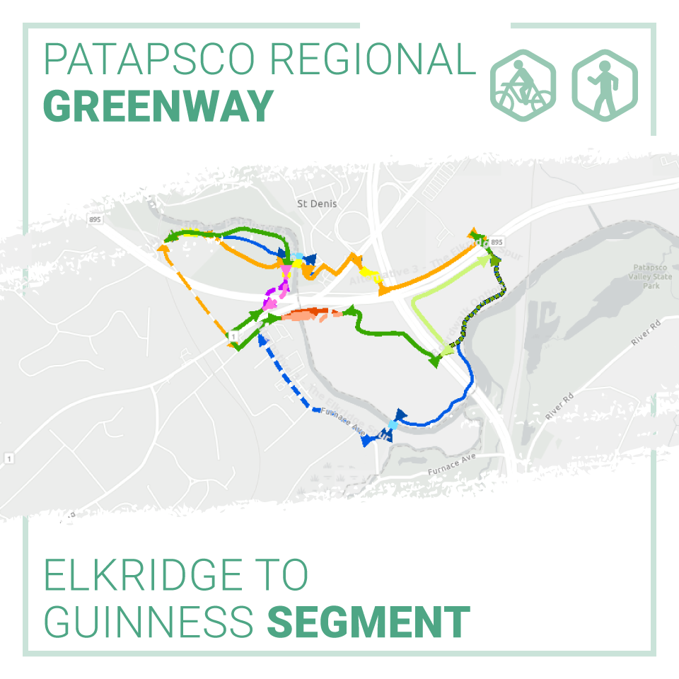
- Alternative 1: The Patapsco Route
- Alternative 2: The Northern Link
- Alternative 3: The Elkridge Spur
Based on input from the public and project partners, a modified version of the Patapsco Route was chosen as the selected alignment and preliminary design drawings were developed.
The Patapsco Route, modified, will provide a practical, constructible and impactful investment. It will provide new pedestrian and bicycle access connecting Howard and Baltimore Counties via a scenic bridge crossing over the Patapsco River, while also leveraging Howard County’s existing investments in the transportation network and the general comfort levels of Main Street and Levering Avenue for biking and walking.
The BRTB currently seeks your input on future design considerations such as seating, bike racks, educational opportunities along the route, overlooks, pet stations, and signage.
In 2021, following the conclusion of public comment and preliminary design, Howard and Baltimore Counties will apply for a grant to complete the design.
Based on your input, and the input of our project partners, the project team will choose a preferred alignment and complete a preliminary design. Once 30% design is completed, Howard and Baltimore Counties will apply for a grant from the Maryland Department of Transportation (MDOT) to complete the design.
Share Your Thoughts
The BRTB invites the public to share their input on future design considerations through Monday, January 11, 2021.
There are four ways you can comment:
- View the StoryMap and take our survey @ https://www.surveymonkey.com/r/9YBWMVZ
- Email your thoughts to comments@baltometro.org
- Call us at 410-732-0500 x 1042 and leave a voicemail with your feedback
- Share your thoughts via Twitter at @BaltoMetroCo | @BmoreInvolved | #BRTBlistens
For more information:
Contact Sheila Mahoney, senior transportation planner, by email at smahoney@baltometro.org, or by phone at 410-732-0500 x 1042.
Notice
The Baltimore Regional Transportation Board operates its programs and services without regard to race, color, or national origin in accordance with Title VI of the Civil Rights Act of 1964, and other applicable laws. Appropriate services can be provided to qualified individuals with disabilities or those in need of language assistance who submit a request at least seven days prior to a meeting. Call 410- 732-0500. Dial 7-1-1 or 800-735-2258 to initiate a TTY call through Maryland Relay. Si se necesita información de Título VI en español, llame al 410-732-0500.

The Traffic Incident Management for the Baltimore Region (TIMBR) Committee of the Baltimore Regional Transportation Board sponsored the Baltimore Regional Virtual Traffic Incident Management (TIM) Conference on Tuesday, November 10. Baltimore Metropolitan Council staff worked closely with TIMBR Committee co-chairs and conference speakers to develop the program.
The conference began with opening remarks from Carroll County Commissioner and BMC Board Vice Chair, Stephen Wantz. He shared his commitment to and personal connection with first responder safety using examples from his time as a firefighter. This was followed by presentations on the dangers responders face when responding to incidents on the road, the continuing need for TIM training, and reminders of actions responders can take to stay safe on the job. The event concluded with a presentation on the status of automated vehicles in Maryland and how organizations in Maryland, including responders, are preparing.
This event occurred during National Traffic Incident Response Awareness Week, November 9 -15. This week aims to remind motorists to slow down and move over when passing incidents and vehicles with flashing lights that are stopped in the road or on the shoulder.

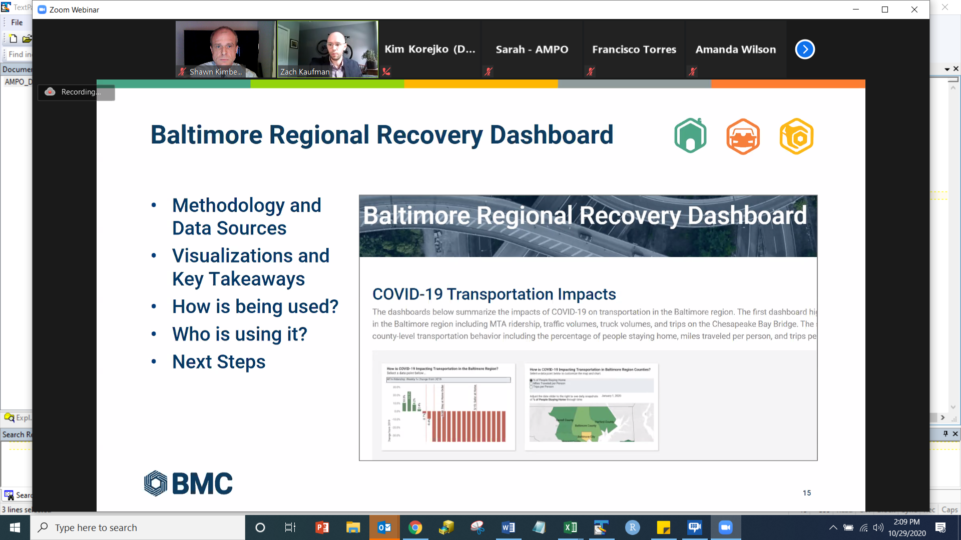
BMC staff members Zach Kaufman and Shawn Kimberly spoke at the virtual Association of Metropolitan Planning Organizations (AMPO) 2020 Annual Conference on Thursday, October 29th.
Their presentation explained the development, purpose and effectiveness of the Baltimore Regional Recovery Dashboard, launched on Wednesday, June 17, to aid local and state partners as they work to assess the impacts of the COVID-19 pandemic. The dashboard includes data analysis and visualizations across BMC’s various areas of focus including housing, transportation, and workforce development.
The presentation focused on the data and methodology utilized to construct the data visualizations, information on how our partners in the region are using it, and next steps for expanding the dashboard.
Zach Kaufman is a transportation planner at BMC. His responsibilities include managing the Baltimore Region Transportation Improvement Program. He also works on labor market data analysis, creating products and reports for workforce development stakeholders in the region.
Shawn Kimberly is a senior transportation planner at BMC. He works with the Cooperative Forecasting Group to develop demographic forecasts vital to BRTB transportation planning activities. He also works on labor market analysis and workforce development reports and products.
The AMPO Annual Conference is the premiere event for MPOs to learn and network. Experts teach and offer a combination of presentations and hands-on learning opportunities.
BMC looks forward to next year's conference.
 |

FOR IMMEDIATE RELEASE CONTACT: Jeff Salzgeber (512) 743-2659
MEDIA ADVISORY
BALTIMORE (October 1, 2020) – Drivers, pedestrians, and bicyclists can expect to see the unexpected when a gaggle of social distancing, spandex-wearing “signal people” hit Baltimore area streets in high-priority areas this month. They’ll be wearing LED-lit backpack billboards with messages for drivers to stop for pedestrians, for walkers to always cross at signal lights and in crosswalks, and for everyone to stay alert and aware of their surroundings.
In recognition of October as national Pedestrian Safety Month, the unconventional messengers are allies of Look Alive campaign spokeswoman Signal Woman — the pedestrian symbol in “walk/don’t walk” signal light boxes who’s been brought to life and is now dishing out practical safety advice on Instagram (@SignalWoman) and Twitter (@Signal_Woman).
The approach is an eye-catching way to draw attention to steps for preventing an increase in crashes between drivers and walkers that typically occur when fall brings less daylight and darker commuting hours. According to the National Highway Traffic Safety Administration, three of every four pedestrian fatalities occur after dark. Last year, there were 61 pedestrian fatalities and 238 serious pedestrian injuries in the Baltimore region.
The Look Alive campaign offers safety tips for drivers and pedestrians (see below). Learn more about the program at LookAliveMD.org.
WHAT:
Street campaign with walking billboards to promote pedestrian safety
DETAILS:
- October 1, 4:30 pm – 7:30 pm, Eastern Avenue (MD150) at Rolling Mill
- October 3, 4:30 pm – 7:30 pm, South Calvert at East Lombard, Baltimore
- October 6, 4:30 pm – 7:30 pm, Liberty Road (MD26) and Old Court Road
VISUALS:
Socially-distancing “Signal People” clad in white spandex from head to toe and wearing LED-lighted walking billboards with important safety reminders. Please make sure media vehicles are parked away from traffic.
STREET SAFETY TIPS
If you’re driving…
- Slow down and obey the speed limit.
- Stop for pedestrians at crosswalks.
- Be careful when passing buses or stopped vehicles.
- When turning, yield to people walking and biking.
- Look for bicyclists before opening your door.
- Allow at least 3 feet when passing bikes.
- Avoid using your cell phone and never text while driving.
If you’re walking…
- Cross the street at crosswalks and intersections.
- Use the pushbuttons.
- Wait for the walk signal to cross the street.
- Watch for turning vehicles.
- Before crossing look left, right, and left again.
- Be visible. Wear something light or reflective after dark.
- Watch out for blind spots around trucks and buses.
- Avoid using your cell phone when crossing the street.
###
The Baltimore Metropolitan Council (BMC) works collaboratively with the chief elected officials in the region to create initiatives to improve our quality of life and economic vitality. BMC, as the Baltimore region’s council of governments, hosts the Baltimore Regional Transportation Board (BRTB), the federal metropolitan planning organization (MPO), and supports local government by coordinating efforts in a range of policy areas including emergency preparedness, housing, cooperative purchasing, environmental planning and workforce development.
BMC’s Board of Directors includes the executives of Anne Arundel, Baltimore, Harford and Howard counties, the mayor of the City of Baltimore, a member of the Carroll County and Queen Anne’s County boards of commissioners, a member of the Maryland State Senate, a member of the Maryland House of Delegates, and a gubernatorial appointee from the private sector.

The Baltimore Regional Transportation Board (BRTB), as the metropolitan planning organization for the Baltimore region, seeks public comments through Friday, July 17 on a new section of the Patapsco Regional Greenway in Howard and Baltimore Counties.
In 2017, the BRTB approved a concept plan for the Patapsco Regional Greenway. Now they are seeking your input on the Elkridge to Guiness route.
Details about the comment period and how to provide comments are available below.
About the Patapsco Regional Greenway
The Patapsco Regional Greenway maps the main alignment of a 40-mile, shared-use trail running through the Patapsco Valley from Baltimore’s Inner Harbor to Sykesville in Carroll County. The trail, if completed, would pass through or near the communities of Cherry Hill, Baltimore Highlands, Halethorpe, Elkridge, Catonsville, Ellicott City, Oella, Daniels, Woodstock, Marriottsville, and Sykesville.
About the Elkridge to Guinness Project
This project will provide preliminary design drawings for a 1.2 to 2.5 mile segment of the Patapsco Regional Greenway connecting Patapsco Valley State Park, Main Street in Elkridge, and the Guinness Open Gate Brewery.
The goals of this project are to:
- build a low-traffic bicycle and pedestrian facility
- improve access to the nearby natural environment
- create a new gateway to downtown Elkridge to support economic development
Choosing the Best Pathway
Earlier this year, the design team studied the area and developed three options, also called “alignment alternatives,” for the Elkridge to Guinness connection and the Patapsco River crossing.
Each of the three potential trail placements include a Patapsco River crossing. All alternatives would also pass through the numerous wetlands and floodplains of the Patapsco River Valley. Federal and State regulations provide protections for the river and its associated wetlands and floodplains, so the design team looked for options that would minimize impacts to these environmental resources.
The BRTB seeks feedback on three possible trail routes. Highlights are below.

- Alternative 1: The Patapsco Route – The Patapsco Route has several options to take trail users through the floodplain of the Patapsco River and into Historic Elkridge via a bridge over the Patapsco River. Changing Main Street in Elkridge to a one-way road would provide enough space for a low-stress separated bike lane. Length: 1.8 Miles; Cost Range: $2.5 to $4.2 Million.
- Alternative 2: The Northern Link – The Northern Link efficiently ties the area of Guinness Open Gate Brewery to the Thomas Viaduct inside the Patapsco Valley State Park. Sharrows, also known as shared lane markings, along the low-volume Levering Avenue would allow trail users to come into Historic Elkridge. Length: 1.2 Miles; Cost Range: $1.9 to $2.4 Million
- Alternative 3: The Elkridge Spur – The Elkridge Spur provides efficient connections between the Guinness Open Gate Brewery, Historic Elkridge and the Park, with an optional loop trail that would also provide an opportunity to enjoy the serenity of the Patapsco River. Length: 2.5 Miles; Cost Range: $3.8 to $4.3 Million
Based on your input, and the input of our project partners, the project team will choose a preferred alignment and complete a preliminary design. Once 30% design is completed, Howard and Baltimore Counties will apply for a grant from the Maryland Department of Transportation (MDOT) to complete the design.
View the alignment options in our StoryMap | Listen to an overview about the project
Share Your Thoughts
The public is invited to share their feedback on the three design alternatives from Monday, July 6 through Friday, July 17, 2020.
There are four ways you can comment:
- View the StoryMap and take our survey @ https://www.surveymonkey.com/
r/98F8M6Q - Email your thoughts to comments@baltometro.org
- Call us at 410-732-0500 x 1042 and leave a voicemail with your feedback
- Share your thoughts via Twitter at @BaltoMetroCo | @BmoreInvolved | #BRTBlistens
For more information:
Contact Sheila Mahoney, senior transportation planner, by email at smahoney@baltometro.org, or by phone at 410-732-0500 x 1042.
Notice
The Baltimore Regional Transportation Board operates its programs and services without regard to race, color, or national origin in accordance with Title VI of the Civil Rights Act of 1964, and other applicable laws. Appropriate services can be provided to qualified individuals with disabilities or those in need of language assistance who submit a request at least seven days prior to a meeting. Call 410-732-0500.

The Baltimore Regional Transportation Board (BRTB), as the metropolitan planning organization (MPO) for the Baltimore region, seeks public comments through Friday, July 17 on two transportation-related documents – the draft 2021-2024 Transportation Improvement Program (TIP) and the associated Air Quality Conformity Determination.
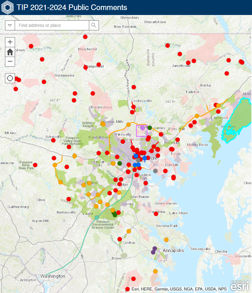
New this year, is an interactive project map, in which the public can view projects and offer comments, and a Storymap which provides an overview of these documents.
Draft 2021-2024 TIP | Air Quality Conformity Determination | How to Comment
Draft 2021 – 2024 Transportation Improvement Program (TIP)
The draft 2021-2024 TIP is the list of regional transportation projects requesting federal funding in the near term. It includes $4.26 billion in proposed federal, state and local money for highway, transit, bicycle and pedestrian projects during the next four years. The funding goes toward maintaining, operating and expanding the transportation system. These projects support regional goals such as accessibility, safety, and prosperity. Funding identified in the TIP is based on funding reasonably expected to be available from local, state, and federal sources.
The draft 2021-2024 TIP includes 140 projects, 24 of which are new. Highlights include:
- Anne Arundel County is dedicating $14 million in funding for a multi-modal transportation center in Parole to serve existing local and regional bus service, with possible future connectivity to modes such as bikeshare, carshare, and ridehailing services;
- In Baltimore City, several new projects focus on increasing bicycle and pedestrian access, including:
- constructing an on-street cycle track on Bush Street in South Baltimore;
- installing an on-street cycle track and/or buffered bike lanes on Eutaw Place near Druid Hill Park;
- building a 2 mile protected cycle track along either Wolfe or Washington Street in East Baltimore; and
- constructing a pedestrian and cyclist trail between the Inner Harbor cycle track and the Middle Branch Trail as part of the Baltimore Greenway Loop that connects Baltimore City's major parks.
- Baltimore County is using $2 million in federal and local funds to purchase vehicles and signage for the Towson Circulator – a new fixed route service in Towson.
- Carroll County is dedicating federal and local funding to 9 essential bridge improvements. In addition, MDOT SHA plans to complete a project in 2021 focused on improving MD 30 Business in Hampstead by reconstructing the existing roadway with ADA-compliant sidewalks and crosswalks, stormwater management, landscaping, and traffic signals.
- Howard County is moving forward with a $26 million project that widens Marriottsville Road from two to four lanes between US 40 and MD 99, including replacing the existing two lane bridge over I-70.
- MDOT SHA is dedicating $281 million in the draft 2021-2024 TIP for the expansion of the Baltimore Beltway (I-695), including conversion of the inside shoulder into a new travel lane from I-70 to MD 43, reconfiguring the interchange of I-695 and I-70, and adding a lane on the outer loop of I-695, from US 40 to MD 144.
- The Maryland Port Administration is partnering with CSX to leverage federal funding to reconstruct the 125-year-old Howard Street Tunnel in order to create double-stack rail access to and from the Port of Baltimore.
- The Maryland Transportation Authority (MDTA) and Baltimore City are collaborating on changes to seven miles of I-95 and sections of Hanover Street, McComas Street and Key Highway. The project seeks to address traffic needs and support ongoing and planned redevelopment of the Port Covington peninsula in South Baltimore.
- MDTA continues its expansion of the I-95 Express Toll Lanes (ETL) by dedicating over $774 million in toll revenues towards implementation of the first phase of the I-95 Section 200 Northbound Extension in Baltimore and Harford Counties.
Please view the draft 2021-2024 TIP through the BRTB’s interactive project map. The draft 2021–2024 TIP is also available in PDF format for download:
Draft 2021-2024 TIP
Introduction and Background | Financial Plan
Projects by jurisdiction: Low-income and Minority Concentration | Appendices
Projects in the draft TIP are also available to review in pdf format by project sponsor, either a local jurisdiction or state agency:
Anne Arundel County | Baltimore City | Baltimore County
Carroll County | Harford County | Howard County
Maryland Port Administration | Maryland Transportation Authority
MDOT MTA | MDOT SHA and the Office of the Secretary
Analysis of Air Quality Conformity
The Baltimore region does not meet the National Ambient Air Quality Standards and so must review its current transportation plans and programs to ensure conformity with the State Air Quality Implementation Plan (SIP).
The Air Quality Conformity Determination report details a comprehensive analysis of Baltimore region mobile source emissions as a result of implementing the draft 2021-2024 TIP. Highlights of the report include:
- Staff from BMC and the Maryland Department of the Environment (MDE) used the Motor Vehicle Emission Simulator (MOVES) 2014a model, developed by the U.S. Environmental Protection Agency (EPA) to analyze the amount of mobile source emissions generated from vehicle travel associated with the implementation of the projects in the draft TIP.
- The report addresses mobile source emissions of VOC and NOx, which are precursors of ground-level ozone emissions.
- New Round 9A forecasts for population, housing, and employment in the Baltimore region were used for this conformity analysis.
- Data about the types and purpose of vehicles, fuel data, and meteorological data from 2017 were used as input into the analysis.
- This Conformity Determination shows that transit ridership is projected to increase in the horizon years.
- Projected mobile source emissions for draft 2021-2024 TIP are well below the motor vehicle emission budgets set in the state implementation plan, or SIP.
- Implementation of the projects proposed in the draft 2021-2024 TIP will not worsen the region’s air quality or delay the timely attainment of national air quality standards.
Why is an air quality analysis needed?
- The Baltimore region is a "marginal" nonattainment area for the ground-level ozone standard set in 2015. This means that levels of ozone pollution in the air are slightly higher than the federally allowable amount of 70 parts per billion (ppb).
- The level of ozone that the region experienced in 2019 as a "design value", or the value that the US EPA uses to determine whether a region is reaching the standard, was 75 ppb. As a result, the region is not attaining the standard and the BRTB must conduct a conformity determination.
- The air quality analysis evaluates whether the transportation projects in a region's TIP and Plan would hinder the progress of that region attaining the air quality standard.
The conformity determination is available in PDF format for download:
Conformity Determination | Appendices
Share Your Thoughts
Public comments are welcome from Tuesday, June 16 through Friday, July 17, 2020. The BRTB will vote on these documents on Tuesday, August 25.
MDOT MTA, in lieu of a separate mandated public comment period, has exercised its option to use the procedures of the BRTB’s public involvement process for the 2021-2024 TIP. The public participation process for the TIP meets the Federal Transit Administration (FTA) public participation requirements for MDOT MTA’s Program of Projects (POP).
View Public Comments Received | View BRTB Response to Comments
Join Us for a Virtual Public Meeting
Those interested in learning more about the draft 2021-2024 TIP and Air Quality Conformity may view our Storymap or join us for a:
- Thursday, July 9 at 6 p.m.
- Tuesday, July 14 at 12:30 p.m.
Join these meetings by using: Computer, Tablet or Smartphone or dial in by phone 877-309-2073 or 571-317-3129 and enter Access Code: 563-035-189.
View a recording of the public meeting
To share your thoughts and ideas, send all comments in writing to:
| ONLINE | FAX | |||
| BRTB Comment Form | comments@baltometro.org | @BaltoMetroCo @BmoreInvolved #BRTBlistens |
The Baltimore Regional Transportation Board 1500 Whetstone Way, Suite 300 Baltimore, MD 21230 |
410-732-8248 |
Comments are also welcome during the public comment opportunity at the BRTB meetings at 9 a.m. on Tuesday, June 23, Tuesday, July 28, or Tuesday, August 25 (scheduled vote).
For more information:
Contact Regina Aris, assistant transportation director, by email at raris@baltometro.org, or by phone at 410-732-9572.
Notice
The Baltimore Regional Transportation Board operates its programs and services without regard to race, color, or national origin in accordance with Title VI of the Civil Rights Act of 1964, and other applicable laws. Appropriate services can be provided to qualified individuals with disabilities or those in need of language assistance who submit a request at least seven days prior to a meeting. Call 410-732-0500.

Comments Welcome on the 2020 Federal Certification of the BRTB
The Federal Highway Administration (FHWA) and the Federal Transit Administration (FTA) invite you to join them on Wednesday, April 22 to share your thoughts about the regional transportation planning process conducted by the Baltimore Regional Transportation Board (BRTB).
The public meeting is part of a 30-day comment period related to a review by FHWA and FTA to certify that the transportation planning process carried out by the BRTB meets federal requirements for Metropolitan Planning Organizations (MPO). The BRTB is the MPO for the Baltimore region.
Comments are welcome on the 2020 Certification of the BRTB through Friday, May 1, 2020.
About the Federal Certification
Every four years, the U.S. Department of Transportation requires FHWA and FTA conduct an on-site review of the BRTB. The purpose of the certification review is to:
- provide an objective evaluation of the regional transportation planning process;
- ensure that federal planning requirements are being satisfactorily implemented by the BRTB;
- provide advice and guidance to the BRTB for ways it can further enhance the effectiveness and efficiency of the planning process and improve the quality of transportation investment decisions; and
- help ensure that the major transportation planning issues facing a metropolitan area are being addressed.
- the public may also provide feedback during the Public Comment Opportunity at the BRTB monthly meeting with elected officials at 9 a.m. on Friday, May 1.
FHWA and FTA also verify that the BRTB are implementing previous recommendations for improvement.
View the Federal Team Presentation |
View the Public Comments and Survey Responses |
Share Your Thoughts
The public review period runs from March 31 through May 1, 2020. There are three ways you can share your thoughts:
TAKE OUR SURVEY |
JOIN US AT A PUBLIC MEETING |
SEND YOUR THOUGHTS IN WRITING |
|---|---|---|
|
Your evaluation of the BRTB can be shared with FHWA/FTA via survey. |
This is an excellent opportunity to directly express your opinion to FHWA and FTA about the work of the BRTB and its efforts to address major transportation issues facing the region. Staff from FHWA and FTA will host an online public meeting to listen to public comments on Wednesday, April 22 from 6 to 7 p.m. Join by: Computer, Tablet or Smartphone Phone: dial United States (Toll Free): 1 877 309 2073 or +1 (571) 317-3129 and enter Access Code: 563-035-189 The public may also provide feedback during the Public Comment Opportunity at the BRTB monthly meeting at 9:45 a.m. on Friday, May 1. Join by: Computer, Tablet or Smartphone Phone: dial United States (Toll Free): 1 877 568 4106 or +1 (312) 757-3129 and enter Access Code: 270-227-325 For any member of the public who wishes to address the BRTB on the day of the meeting, they may do so by emailing a short statement (no more than 375 words) to tlang@baltometro.org. These statements must be received no later than 9 A.M. on May 1, 2020 to be relayed to the board at the meeting. |
Please send all comments in writing to: ONLINE: BRTB Comment Form EMAIL: comments@baltometro.org TWITTER: @BaltoMetroCo | @BmoreInvolved | #BRTBlistens MAIL: The Baltimore Regional Transportation Board | 1500 Whetstone Way, Suite 300 | Baltimore, MD 21230 FAX: 410-732-8248 |
BMC is accessible by the MDOT MTA 94 and 71 bus lines, as well as the Charm City Circulator's Banner Route. There is also vehicle and bicycle parking on-site. Directions to BMC
The BRTB is the federally recognized metropolitan planning organization (MPO) for transportation in the region. BMC provides the BRTB with staff support.
The BRTB operates its programs and services without regard to race, color, or national origin in accordance with Title VI of the Civil Rights Act of 1964, and other applicable laws. Appropriate services can be provided to qualified individuals with disabilities or those in need of language assistance who submit a request at least seven days prior to a meeting. Call 410-732-0500.
