Pedestrian Infrastructure Assessment Toolkit
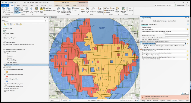
The Pedestrian Infrastructure Assessment Toolkit (PIAT) was developed by the Baltimore Regional Transportation Board in partnership with member jurisdictions. The PIAT includes three toolboxes designed to help member jurisdictions identify pedestrian infrastructure needs and prioritize potential pedestrian infrastructure projects.
The three toolboxes are:
- Data Management Toolbox –Create your own geodatabases structured to work with the PIAT, import your own layers and update existing layers.
- Needs Assessment Toolbox— Identify sidewalk and pedestrian crossing gaps, and evaluate pedestrian travelsheds. A travelshed is the area that can be traveled within a defined distance; 1) using continuous sidewalks and crosswalks, 2) by traveling in a straight-line or “as the crow flies” or 3) by using a user supplied network such as a street network.
- Prioritization Toolbox—Develop a ranked priority list of pedestrian infrastructure improvement locations. User can choose from a variety of demographic, transportation, and spatial variables and adjust their relative weights. The locations can be identified through the Needs Assessment Toolbox above, or through another process.
To use the PIAT, you will need:
- ArcGIS Pro—the Toolkit has been developed and tested in ArcGIS Pro 2.9.0.
- ArcGIS Pro Advanced license—needed for the Needs Assessment Toolbox to function fully. Basic and Standard license levels will work with limited functionality. See Section III.B in the manual for additional information.
- Spatial Analyst extension—needed for the Travelshed Analysis Tool.
- GIS experience related to data formatting.
- Sidewalk data—Can be acquired from OpenStreetMap.org or through the open data site for your city or county, if they have a publicly available sidewalk dataset. Note that this sidewalk data must be processed to be formatted as indicated in Appendix A of the Manual and imported according to instructions in Section II of the Manual.
Regional Bicycle Facilities Inventory
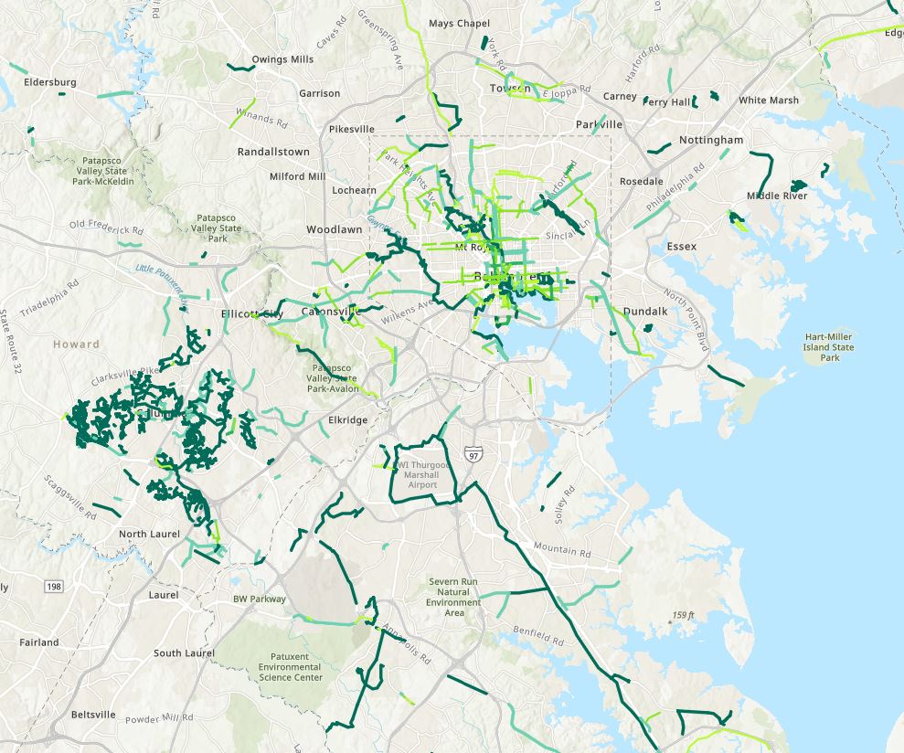
The regional bicycle facilities inventory originated with BPAG and the need to create a regional map of all current, programmed, and planned bicycle facilities to aid the planning process. The regional inventory is updated using bicycle facilities inventories maintained by each jurisdiction.
A map of the regional bicycle facilities inventory containing existing bicycle facilities can be viewed here. The raw ArcGIS data for the inventory can be downloaded via BMC’s Regional GIS Data Center.
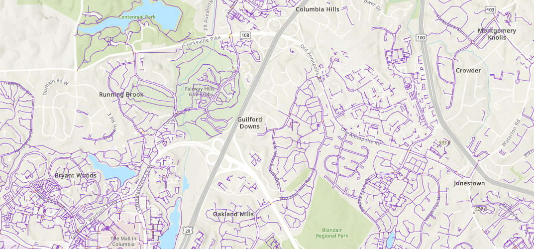
Baltimore Region Pedestrian Network
The Baltimore Region Pedestrian Network is a comprehensive sidewalk, crosswalk, curb ramp, and sidewalk buffer (planting strip) dataset. It was derived from 2001 imagery and was acquired by BMC to assist member jurisdictions with pedestrian planning in the region including identifying sidewalk and crosswalk gaps, prioritizing sidewalk projects, and other pedestrian planning efforts.
Cost Estimating Tool For Bicycle Infrastructure Projects
This planning level cost estimating tool has been developed by the Maryland Department of Transportation and the Baltimore Regional Transportation Board's Bicycle and Pedestrian Advisory Group. The purpose of this estimator is to provide guidance to local jurisdictions on project design and construction costs associated with bicycle infrastructure. Cost estimates within this tool are developed by identifying pay items and establishing generalized quantities, and a 30% contingency to allow for items not yet designed. The cost estimator is also provided as a general planning tool to compare costs from planning, development and engineering professionals. This tool was developed in December 2020 and will be updated annually.