Baltimore County and the Baltimore Metropolitan Council host the 13th Annual Meet the Primes Virtual event on Wednesday, October 13th, 2021, where small and minority owned businesses (MBE/SBE) are connected with prime contract bidders.
The event provides a chance for attendees to speak directly with a representative from a prime company or government agency that has identified sub-contracting needs for their current and upcoming projects.
Over 60 exhibitors attended this event.
The virtual event also hosted breakout sessions giving exhibitors the opportunity to hold discussions away from the group meeting. This allows businesses the opportunity to pick which exhibitors they would like to hear from, similar to visiting a booth at a physical event.
This event continues to empower those in our region to build new partnerships and access the buying capacity of our governments.
Five years after BMC and the region’s public housing authorities (PHAs) received a seed grant and issued our first request for proposals (RFP), our Regional Project-Based Voucher (PBV) Program is bringing new affordable homes to several communities and helping low-income families access the full educational and economic opportunity of our metropolitan area.
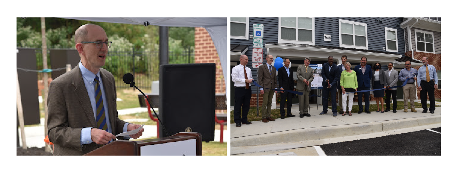
On August 30, BMC Housing Policy Coordinator Dan Pontious joined Howard County Executive Calvin Ball, Maryland Housing Secretary Ken Holt, Howard County Housing Commission Executive Director Peter Engel, and officials from the Woda Cooper Companies to cut the ribbon on Robinson Overlook, a new 48-unit Woda Cooper development of affordable rental homes in the Hickory Ridge Village of Columbia.
BMC was proud to take part in this event where rent subsidies in our program award, along with highly competitive Low Income Housing Tax Credits and other funding from the state, helped Woda Cooper secure key financing for Robinson Overlook. Our voucher award also ensures that eight low-income families from our participating jurisdictions will be able to live in this attractive, safe community and have their children attend Howard County’s high-performing schools.
Robinson Overlook joins the recently-opened Riverwatch II in Elkridge and Homes for Fountain Green in Bel Air as the first Regional PBV awardees to lease affordable homes to families. They are three of eleven total awardees in five jurisdictions that have received a total of 101 project-based vouchers. Those eleven developments in our region include nearly 800 overall rental homes affordable to households at various incomes.
The vouchers in this program come from the six participating housing authorities – the Housing Authorities of the Cities of Baltimore and Annapolis, Baltimore County Department of Housing and Community Development, Housing Commission of Anne Arundel County, Howard County Housing Commission, and Harford County Housing Agency – as well as the nonprofit Baltimore Regional Housing Partnership (BRHP).
BRHP, which already carries out a significant regional program using Housing Authority of Baltimore City vouchers, administers all of the project-based vouchers in our program and provides housing counseling to participants, as well. That counseling includes help with any credit issues, family budgeting, and guidance on working with property owners and managers, as well as rights and responsibilities as a tenant.
This Regional PBV Program is part of BMC’s work with local housing authorities and jurisdictions to carry out their duty to affirmatively further fair housing. That duty, imposed by the 1968 Fair Housing Act, is to operate housing programs that counter the federal government’s prior history of promoting racial segregation that excluded African Americans and other racial groups from educational and economic opportunity.
The Regional PBV Program began in 2016 through a pool of 100 project-based vouchers pledged by participants and a $550,000 seed grant from the U.S. Department of Housing and Urban Development (HUD) for central coordination and housing mobility counseling. Collaborating agencies have now added 93 more vouchers to the regional pool and are sustaining the funding of central coordination at BMC. A rolling RFP is open through 2021.
 |

The Baltimore Regional Transportation Board (BRTB), as the metropolitan planning organization for the Baltimore region, seeks public comments from Thursday, September 30, 2021 through Friday, October 29 on the preferred alternatives for a new section of the Patapsco Regional Greenway in Carroll County. The BRTB invites the public to learn more about these proposed alignments at a public meeting on Thursday, September 30 at 6:00 p.m.
In 2017, the BRTB approved a concept plan for the Patapsco Regional Greenway, which will be used by bicyclists, hikers, runners, walkers, and in some locations, equestrians. To date, over 12 miles of the greenway have been completed. Now, the BRTB seeks your input on the preferred alignments for the Sykesville to McKeldin Segment, which will add another 8.5 miles to the greenway.
Details about the comment period and how to provide comments are available below.
About the Patapsco Regional Greenway
The Patapsco Regional Greenway maps the main alignment of a 40-mile, shared-use trail traveling through the Patapsco Valley from Sykesville in Carroll County to Baltimore’s Inner Harbor. The trail, when completed, would pass through or near the communities of Sykesville, Marriottsville, Woodstock, Daniels, Oella, Ellicott City, Catonsville, Elkridge, Halethorpe, Baltimore Highlands, and Cherry Hill. The Patapsco Regional Greenway will serve as a region-wide asset and provide nearby communities with a sustainable transportation route and miles of recreational trails.
About the Sykesville to McKeldin Area Project
The Sykesville to McKeldin Segment of the Patapsco Regional Greenway consists of two sections - 1) the western portion near downtown Sykesville and 2) the eastern portion near the McKeldin area of the Patapsco Valley State Park.
In Spring 2021, a comment period was held to gather feedback on the alignment of each of these trail segments. After reviewing comments, a route for each section was selected. Details are below.
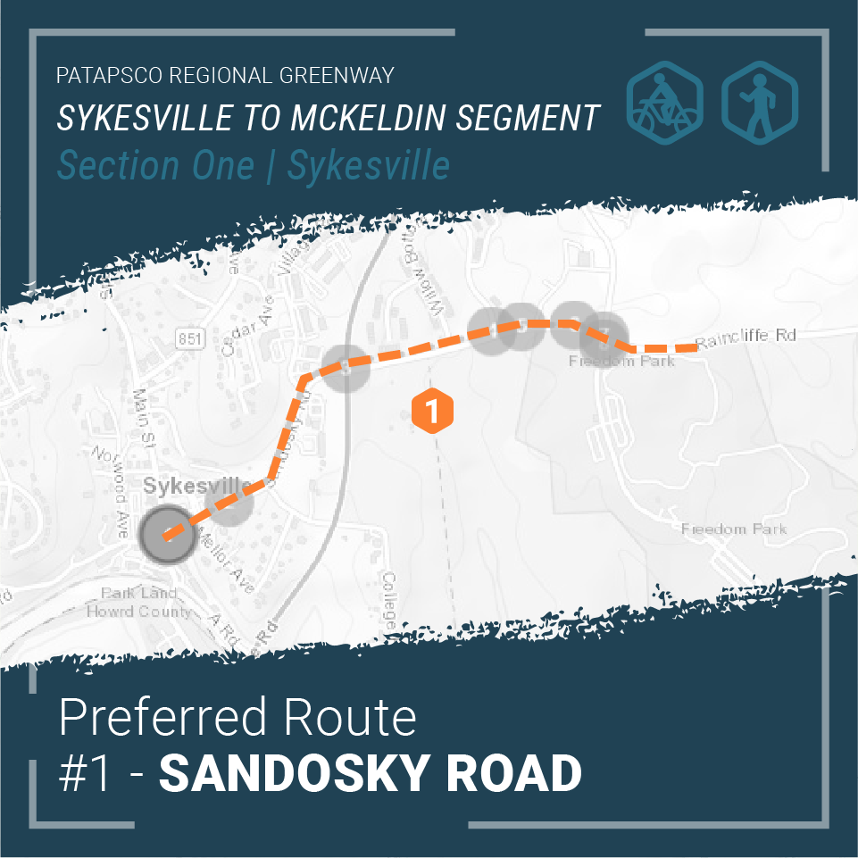
Section 1 - Western Portion: Main Street Sykesville to Freedom Park
The western portion will connect downtown Sykesville shops, dining, and residences along Main Street to active and passive recreation opportunities in Freedom Park. This section of the trail is intended for low impact trail users such as walkers and cyclists and will consist primarily of paved shared use paths, on-road facilities, and a boardwalk structure along Sandosky Road.
Two alignment alternatives for Section 1 were considered during the public input period this Spring. The design team considered public comments, steering committee comments, local advisory committee comments, and general design principles in identifying the Sandosky Road alignment as the preferred alignment.
The Sandosky Road alignment is a paved shared use path that travels from Main Street in downtown Sykesville, north along Sandosky Road, crossing MD 32 to Raincliffe Road and finally into Freedom Park via the Buttercup Road intersection.
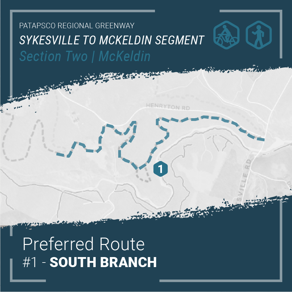
Section 2 - Eastern Portion: Freedom Park to the McKeldin Area in Patapsco Valley State Park
Users of this section of the trail will encounter dense forest, scenic views, ruins of abandoned structures, stream crossings, and many other points of interest. The design will highlight the natural and cultural wonders of the park integrating high overlooks, rock formations, and archaeological treasures. The natural surface trail will serve hikers, mountain bikers, and equestrian riders with a sustainably constructed unpaved trail.
Similar to the western portion, the eastern portion considered two alignment alternatives through the Patapsco Valley State Park. The eastern portion of the multi-use trail will connect Freedom Park with the McKeldin Area of the Patapsco Valley State Park. Utilizing public comments, steering committee comments, advisory committee comments, and sound engineering judgement, the South Branch alignment was selected as the preferred alignment.
The South Branch alignment begins in Freedom Park and meanders through Patapsco Valley State Park towards the Heart of Maryland Bowhunters Club property. From there, the multi-use trail veers south towards the South Branch of the Patapsco River crossing over the historic Henryton rail tunnel, through the historic Henryton Sanitorium, paralleling Henryton Road and finally crossing Marriottsville Road before ending in the McKeldin area of the Patapsco Valley State Park.
Share Your Thoughts
The public is invited to share their feedback on the preferred alternatives for the Patapsco Regional Greenway: Sykesville to McKeldin Segment from Thursday, September 30, 2021 through Friday, October 29, 2021.
A virtual public meeting was held on September 30, 2021 to share information about this project and the preferred alternatives.
View the Recorded Presentation
There are also several ways you can provide comments in writing:
- Add your comments to our project page at https://publicinput.com/prgsykesville
- Email your thoughts to prgsykesville@PublicInput.com
- Text prgsykesville to 855-925-2801 to share your comments
- Call us at 855-925-2801 x 3163 and leave a voicemail with your feedback
- @BaltoMetroCo @BmoreInvolved | Use #BRTBlistens
For more information:
Contact Keith Kucharek, Transportation Planner, by email at kkucharek@baltometro.org, or by phone at 410-732-0500 x1052.
Notice
The Baltimore Regional Transportation Board operates its programs and services without regard to race, color, or national origin in accordance with Title VI of the Civil Rights Act of 1964, and other applicable laws. Appropriate services can be provided to qualified individuals with disabilities or those in need of language assistance who submit a request at least seven days prior to a meeting. Call 410- 732-0500. Dial 7-1-1 or 800-735-2258 to initiate a TTY call through Maryland Relay. Si se necesita información de Título VI en español, llame al 410-732-0500.

The Baltimore Regional Transportation Board (BRTB), as the metropolitan planning organization for the Baltimore region, seeks public comments through Friday, June 11 on a new section of the Patapsco Regional Greenway in Carroll County and Howard County.
In 2017, the BRTB approved a concept plan for the Patapsco Regional Greenway, which will be used by bicyclists, hikers, runners, walkers, and in some locations, equestrians. To date, over 12 miles of the greenway have been completed. Now, the BRTB seeks your input on the Sykesville to McKeldin Segment, which will add another 8.5 miles to the greenway.
Details about the comment period and how to provide comments are available below.
About the Patapsco Regional Greenway
The Patapsco Regional Greenway maps the main alignment of a 40-mile, shared-use trail traveling through the Patapsco Valley from Sykesville in Carroll County to Baltimore’s Inner Harbor. The trail, when completed, would pass through or near the communities of Sykesville, Marriottsville, Woodstock, Daniels, Oella, Ellicott City, Catonsville, Elkridge, Halethorpe, Baltimore Highlands, and Cherry Hill. The Patapsco Regional Greenway will serve as a region-wide asset and provide nearby communities with a sustainable transportation route and miles of recreational trails.
About the Sykesville to McKeldin Area Project
The Sykesville to McKeldin Segment of the Patapsco Regional Greenway consists of two sections - 1) the western portion near downtown Sykesville and 2) the eastern portion near the McKeldin area of the Patapsco Valley State Park.
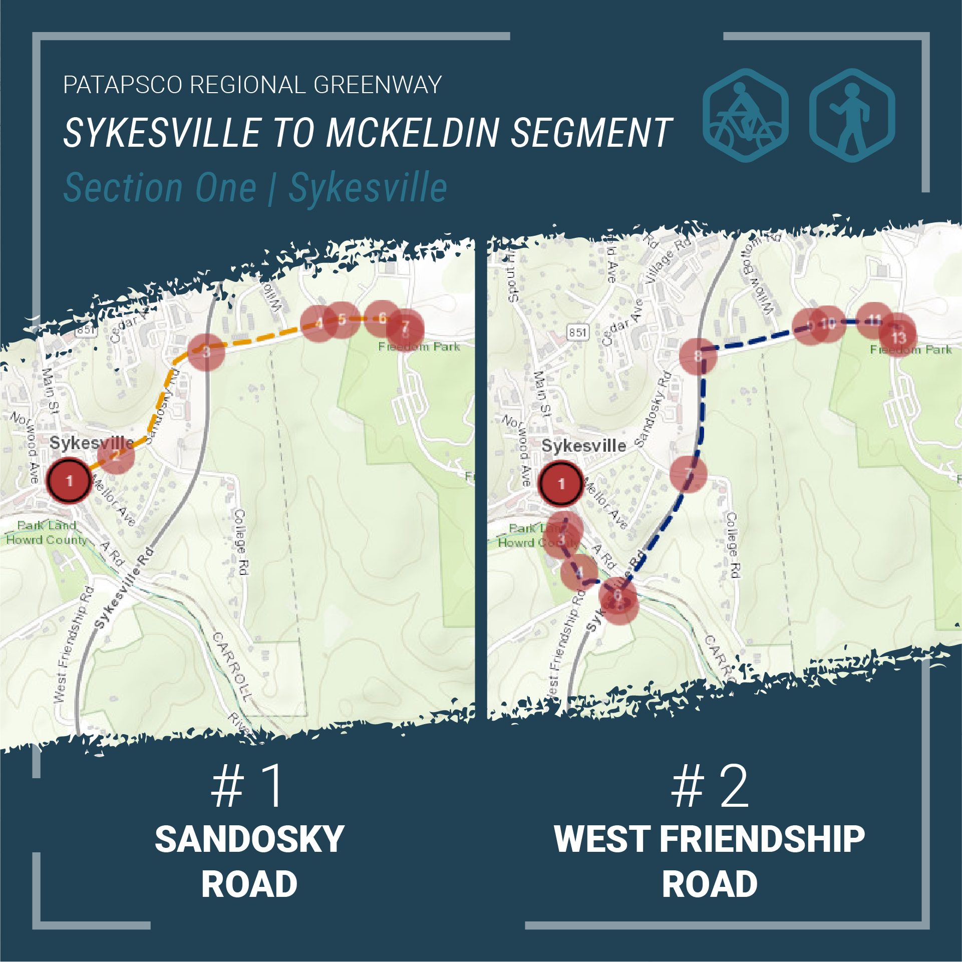
Section 1 - Western Portion: Main Street Sykesville to Freedom Park
The western portion will connect downtown Sykesville shops, dining, and residences along Main Street to active and passive recreation opportunities in Freedom Park. There are two alignment alternatives for Section 1 - Western Portion: Main Street to Freedom Park.
- Alignment 1: Sandosky Road
A shared-use trail travels from Main Street in downtown Sykesville, then north along Sandosky Road to Raincliffe/Buttercup Road intersection, and finally into Freedom Park. - Alignment 2: MD 32
Begins on Main Street in downtown Sykesville and travels south. The shared-use trail crosses the Patapsco River and turns onto West Friendship Road. The trail then turns onto River Road and travels south. The trail re-crosses the Patapsco River along an abandoned vehicular overpass and continues north along MD 32 to rejoin the sidewalk on Raincliffe Road. And finally the trail travels briefly south from the Raincliffe/Buttercup Road intersection into Freedom Park.
Both options will explore sidewalks and paved pathways to accommodate safe and comfortable use by pedestrians and bicyclists.
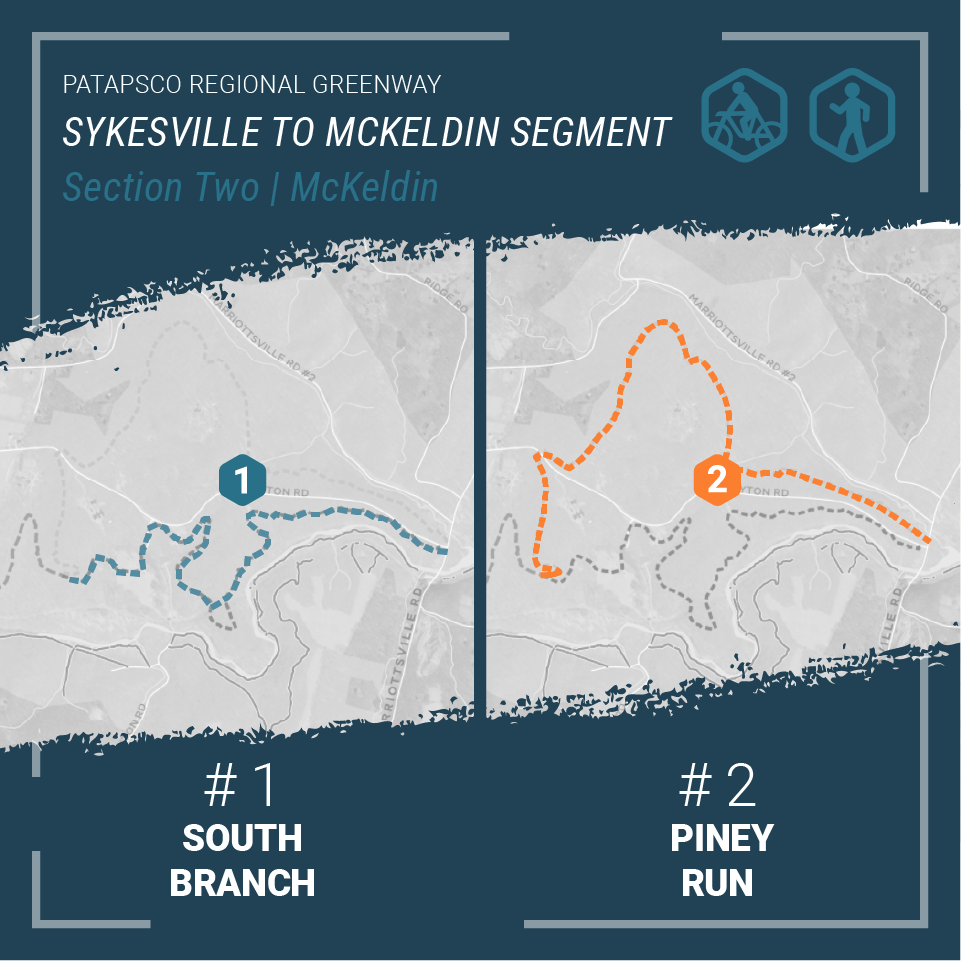
Section 2 - Eastern Portion: Freedom Park to the McKeldin Area in Patapsco Valley State Park
The eastern portion of the shared-use trail will connect Freedom Park with the McKeldin Area of the Patapsco Valley State Park. There are two alignment alternatives for Section 2 - Eastern Portion: Freedom Park to McKeldin Area.
- Alignment 1: South Branch
Meanders through Patapsco Valley State Park towards the Heart of Maryland Bowhunters Club property. From there, the shared-use trail veers south towards the South Branch of the Patapsco River. The trail then follows the South Branch to Marriottsville Road and crosses Marriottsville Road before ending in the McKeldin area of the Patapsco Valley State Park. - Alignment 2: Piney Run
Follows the same path as Alignment 1: South Branch until the shared-use trail passes beyond the Heart of Maryland Bowhunters Club property. The trail then travels north up and around the League of Maryland Horsemen property towards Piney Run. The trail veers south and parallels Piney Run until the trail reaches Marriottsville Road. After crossing Marriottsville Road, the trail follows the Alignment 1: South Branch before ending in the McKeldin Area of the Patapsco Valley State Park.
Both options will follow a similar path through the Patapsco Valley State Park encountering dense forest, scenic views, ruins of abandoned structures, stream crossings, and many other points of interest. The design will also celebrate the natural and cultural wonders of the park integrating high overlooks, rock formations, and archaeological treasures. The natural surface trail will serve hikers, mountain bikers, and equestrian riders with a sustainably constructed unpaved trail.
The purpose of this project is to explore the opportunities and challenges of the alignments, identify design details, engage the public in key decisions, and prepare a 30% design document that will carry the project into final design and construction.
View the alignment options in our StoryMap |
Share Your Thoughts
The public is invited to share their feedback on the alignment alternatives for the Patapsco Regional Greenway: Sykesville to McKeldin Segment from Thursday, May 6 through Friday, June 11.
There are six ways you can comment:
- View the StoryMap and take our survey
- Join us for a public meeting on Thursday, May 27 at 6:30 p.m.
- Email your thoughts to M503@PublicInput.com
- Text M503 to 73224 to share your thoughts
- Call us at 855-925-2801, x 7772 and leave a voicemail with your feedback
- Share your thoughts via Twitter at @BaltoMetroCo | @BmoreInvolved | #BRTBlistens
For more information:
Contact Keith Kucharek, Transportation Planner, by email at kkucharek@baltometro.org, or by phone at 410-732-0500 x1052.
Notice
The Baltimore Regional Transportation Board operates its programs and services without regard to race, color, or national origin in accordance with Title VI of the Civil Rights Act of 1964, and other applicable laws. Appropriate services can be provided to qualified individuals with disabilities or those in need of language assistance who submit a request at least seven days prior to a meeting. Call 410- 732-0500. Dial 7-1-1 or 800-735-2258 to initiate a TTY call through Maryland Relay. Si se necesita información de Título VI en español, llame al 410-732-0500.

The members of the Baltimore Reservoir Watershed Protection Committee (WPC) have executed a new Action Strategy for the Reservoir Watersheds.
Finalized in 2019, this Action Strategy details the measures that members have agreed to carry out in order to protect the quality of the region’s three drinking water reservoirs, and their tributaries. The affected watersheds feed the Loch Raven, Prettyboy and Liberty reservoirs.
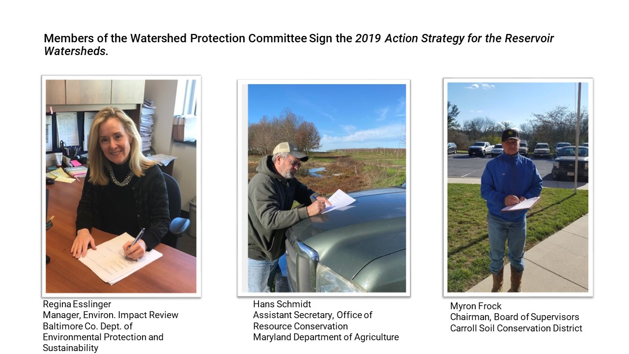 Measures include both policy and program commitments to advance watershed protection, restoration, and management. The new Action Strategy builds upon a 2005 agreement and includes new efforts to: implement an enhanced monitoring plan, reduce road salt runoff; and explore funding opportunities.
This important agreement will also continue policies and practices in water quality monitoring and analysis; point source management; nonpoint source management; planning, zoning and development; resource protection and restoration; management of city-owned watersheds; toxics, spills, pathogens, and disinfectant by-products; reservoir watershed program coordination; and public awareness.
Members of the WPC include staff representing Baltimore, Carroll, Harford, and Howard Counties, Baltimore City, the Maryland Departments of the Environment and Agriculture, Baltimore County and Carroll Soil Conservation Districts, and the Baltimore Metropolitan Council.

The Baltimore Metropolitan Council (“BMC”) has released a Public Access Database for the Maryland Travel Survey (MTS) that it recently conducted on behalf of MDOT.
The Maryland Travel Survey is BMC’s primary source for demographic and travel data. Individual and Household demographics (e.g., gender, income, employment status, age, and number of children) have more influence over people’s travel activity and travel need than any other factor. Demographics are important for planning all transportation modes and are particularly important for planning transit service, where data on demand for transit service is aggregated by cohorts, e.g., young adults, elderly, etc.
The MTS Public Access Database (PADB) is available to researchers and the general public. It provides access to the MTS Survey data at a level of detail that allows for in-depth analysis of demographics and travel behavior, while also protecting the confidential information of Survey households.
“The MTS Public Access Database will make the results of the Maryland Travel Survey, which encompassed the Eastern Shore, the Baltimore Region, and Western Maryland, available to a much larger audience,” said BMC Director of Transportation Planning, Todd Lang.
Those wishing to access the PADB should follow the link to the BMC Website and complete the online Request Form, making sure to provide their contact information. Once BMC receives your request, we will email the PADB to you.

The Baltimore Regional Transportation Board (BRTB), as the metropolitan planning organization (MPO) for the Baltimore region, seeks public comments through Monday, January 11 on a part of the Patapsco Regional Greenway in Howard and Baltimore Counties.
Earlier this year the BRTB sought feedback on three options or “alignment alternatives” for the Elkridge to Guinness connection. Based on that feedback, a modified Patapsco Route was selected and now the BRTB seeks your input on future design considerations such as seating, bike racks, educational opportunities along the route, overlooks, pet stations, and signage.
Details about the comment period and how to provide comments are available below.
About the Patapsco Regional Greenway
The Patapsco Regional Greenway envisions a 40-mile, shared-use trail running through the Patapsco Valley from Baltimore’s Inner Harbor to Sykesville in Carroll County. This trail, when completed, would pass through or near the communities of Cherry Hill, Baltimore Highlands, Halethorpe, Elkridge, Catonsville, Ellicott City, Oella, Daniels, Woodstock, Marriottsville, and Sykesville.
About the Elkridge to Guinness Project
The purpose of the project is to develop preliminary design drawings for a segment of the Patapsco Regional Greenway connecting Patapsco Valley State Park, Main Street in Elkridge, and the Guinness Open Gate Brewery.
The goals of this project are to:
- build a low-traffic bicycle and pedestrian facility
- improve access to the nearby natural environment
- create a new gateway to downtown Elkridge to support economic development
Choosing the Best Pathway
Earlier this year, the design team presented three options or “alignment alternatives” for the Elkridge to Guinness connection for your review and comments:
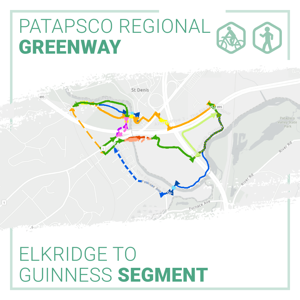
- Alternative 1: The Patapsco Route
- Alternative 2: The Northern Link
- Alternative 3: The Elkridge Spur
Based on input from the public and project partners, a modified version of the Patapsco Route was chosen as the selected alignment and preliminary design drawings were developed.
The Patapsco Route, modified, will provide a practical, constructible and impactful investment. It will provide new pedestrian and bicycle access connecting Howard and Baltimore Counties via a scenic bridge crossing over the Patapsco River, while also leveraging Howard County’s existing investments in the transportation network and the general comfort levels of Main Street and Levering Avenue for biking and walking.
The BRTB currently seeks your input on future design considerations such as seating, bike racks, educational opportunities along the route, overlooks, pet stations, and signage.
In 2021, following the conclusion of public comment and preliminary design, Howard and Baltimore Counties will apply for a grant to complete the design.
Based on your input, and the input of our project partners, the project team will choose a preferred alignment and complete a preliminary design. Once 30% design is completed, Howard and Baltimore Counties will apply for a grant from the Maryland Department of Transportation (MDOT) to complete the design.
Share Your Thoughts
The BRTB invites the public to share their input on future design considerations through Monday, January 11, 2021.
There are four ways you can comment:
- View the StoryMap and take our survey @ https://www.surveymonkey.com/r/9YBWMVZ
- Email your thoughts to comments@baltometro.org
- Call us at 410-732-0500 x 1042 and leave a voicemail with your feedback
- Share your thoughts via Twitter at @BaltoMetroCo | @BmoreInvolved | #BRTBlistens
For more information:
Contact Sheila Mahoney, senior transportation planner, by email at smahoney@baltometro.org, or by phone at 410-732-0500 x 1042.
Notice
The Baltimore Regional Transportation Board operates its programs and services without regard to race, color, or national origin in accordance with Title VI of the Civil Rights Act of 1964, and other applicable laws. Appropriate services can be provided to qualified individuals with disabilities or those in need of language assistance who submit a request at least seven days prior to a meeting. Call 410- 732-0500. Dial 7-1-1 or 800-735-2258 to initiate a TTY call through Maryland Relay. Si se necesita información de Título VI en español, llame al 410-732-0500.

The Traffic Incident Management for the Baltimore Region (TIMBR) Committee of the Baltimore Regional Transportation Board sponsored the Baltimore Regional Virtual Traffic Incident Management (TIM) Conference on Tuesday, November 10. Baltimore Metropolitan Council staff worked closely with TIMBR Committee co-chairs and conference speakers to develop the program.
The conference began with opening remarks from Carroll County Commissioner and BMC Board Vice Chair, Stephen Wantz. He shared his commitment to and personal connection with first responder safety using examples from his time as a firefighter. This was followed by presentations on the dangers responders face when responding to incidents on the road, the continuing need for TIM training, and reminders of actions responders can take to stay safe on the job. The event concluded with a presentation on the status of automated vehicles in Maryland and how organizations in Maryland, including responders, are preparing.
This event occurred during National Traffic Incident Response Awareness Week, November 9 -15. This week aims to remind motorists to slow down and move over when passing incidents and vehicles with flashing lights that are stopped in the road or on the shoulder.

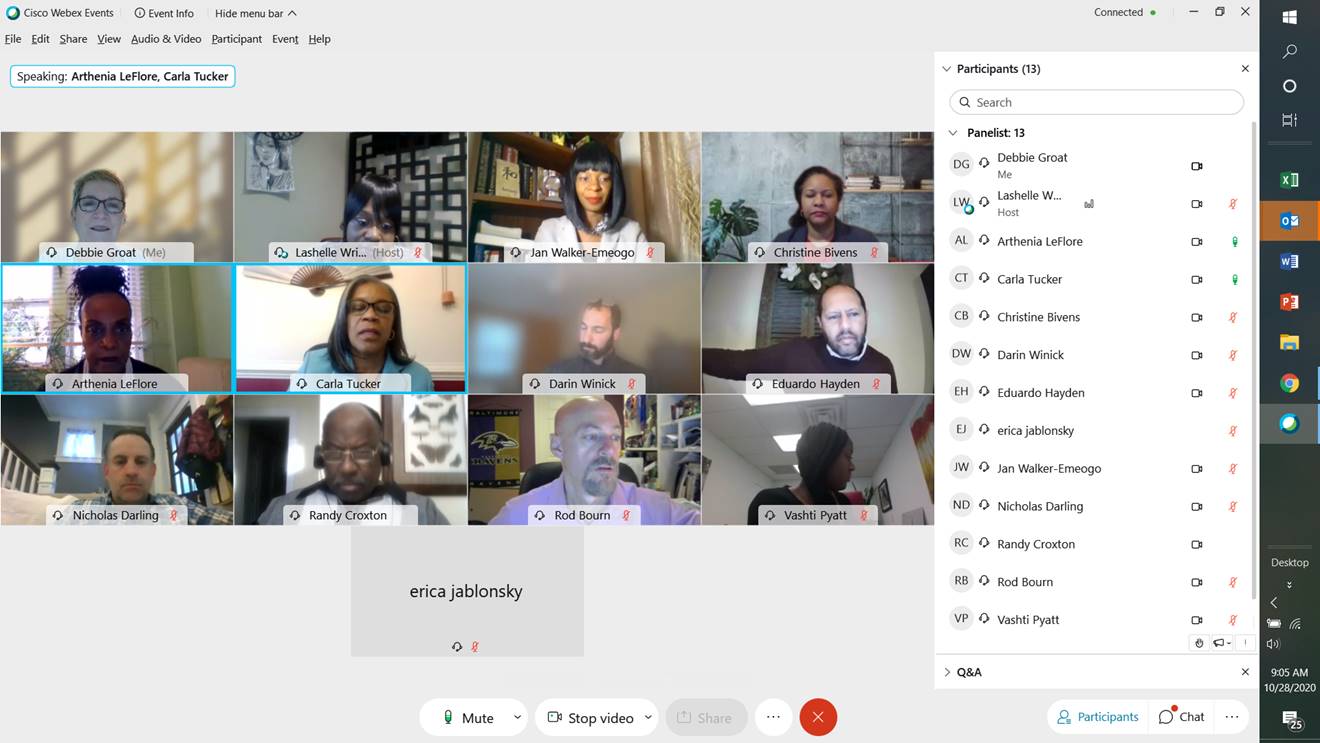
On Wednesday, October 28, 2020, The Baltimore Metropolitan Council’s (BMC) Baltimore Regional Cooperative Purchasing Committee (BRCPC) co-hosted the 12th Annual Meet the Primes event. This virtual procurement outreach event connects small and minority owned businesses (MBE/SBE) to prime contract bidders.
The event welcomed over 500 small and minority business participants.
Organized by Baltimore County, Meet the Primes utilized virtual training and presentation sessions to provide information to attendees. Participants reviewed updates in the financial systems for solicitations, submitting bids and obtaining purchase orders for new and existing vendors, as well as hosted discussions for potential vendors to learn about the various business resources including the BRCPC.
Small business representatives also met with select government agencies and prime companies during pre-scheduled one-to-one introduction meetings. These meetings presented opportunities for attendees to present their products and services directly to the procurement officials, buyers and decision makers who may be interested in their offerings.
In addition to the one-to-one sessions and virtual training and presentation sessions, the event also utilized business listings to display contact information creating a database of participating small and minority owned businesses.
This event presents unique opportunities for small and minority owned businesses, empowering those in our region to build new partnerships and access the buying capacity of our governments.
We are hopeful that we can return in-person for next year’s Meet the Primes event, scheduled for Wednesday, October 13, 2021.
 |

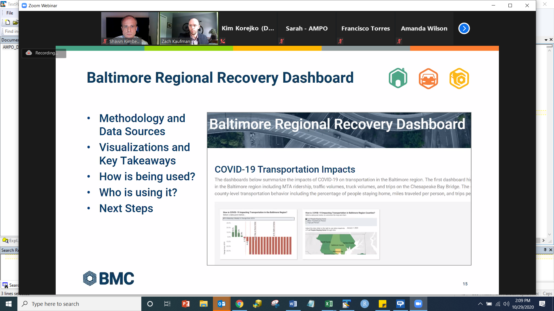
BMC staff members Zach Kaufman and Shawn Kimberly spoke at the virtual Association of Metropolitan Planning Organizations (AMPO) 2020 Annual Conference on Thursday, October 29th.
Their presentation explained the development, purpose and effectiveness of the Baltimore Regional Recovery Dashboard, launched on Wednesday, June 17, to aid local and state partners as they work to assess the impacts of the COVID-19 pandemic. The dashboard includes data analysis and visualizations across BMC’s various areas of focus including housing, transportation, and workforce development.
The presentation focused on the data and methodology utilized to construct the data visualizations, information on how our partners in the region are using it, and next steps for expanding the dashboard.
Zach Kaufman is a transportation planner at BMC. His responsibilities include managing the Baltimore Region Transportation Improvement Program. He also works on labor market data analysis, creating products and reports for workforce development stakeholders in the region.
Shawn Kimberly is a senior transportation planner at BMC. He works with the Cooperative Forecasting Group to develop demographic forecasts vital to BRTB transportation planning activities. He also works on labor market analysis and workforce development reports and products.
The AMPO Annual Conference is the premiere event for MPOs to learn and network. Experts teach and offer a combination of presentations and hands-on learning opportunities.
BMC looks forward to next year's conference.
 |
